Irmo night lights from space
Night Light of Irmo (South Carolina) from space (United States) Src. Average luminocity for 10x10km area is 75.4476% and for 50x50km: 42.8511%.
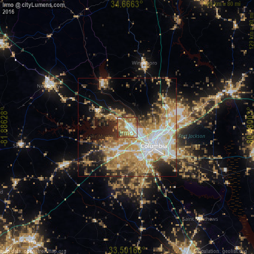
Analysis of Irmo night lights 2016
Square area 10x10 km:
 13.46%
90-99
14.34%80-89
16.61%70-79
11.89%60-69
26.57%50-59
9.97%40-49
2.27%30-39
4.9%20-29
0%10-19
0%0-9
0%Square area 50x50 km:
7.88%90-99
6.84%80-89
7.07%70-79
8.24%60-69
8.91%50-59
4.25%40-49
4.04%30-39
6.2%20-29
6.34%10-19
12.7%0-9
27.54%Clear (daylight) street map image can be seen on geolist.org.
Map coordinates:
34° 39' 58.7" North, 81° 53' 10.6" West
34° 5' 9.5" North, 81° 10' 59.3" West
33° 30' 6" North, 80° 28' 48.1" West
Some cities around Irmo sort by population:
• Columbia
16.6 km =10.3 mi,  124°
124°
• Saint Andrews
6.7 km =4.2 mi,  132°
132°
• Lexington
12.6 km =7.8 mi,  202°
202°
• West Columbia
14.4 km =8.9 mi,  135°
135°
• Seven Oaks
5.3 km =3.3 mi, 140°
• Cayce
16.7 km =10.4 mi, 143°
• Oak Grove
12.3 km =7.6 mi,  162°
162°
• Lake Murray of Richland
8.4 km =5.2 mi,  297°
297°
4583057 (p: 12,056)
Sources (retrieved 2019-11-25):
» Earth at Night: Flat Maps 2012, 2016