Inniswold night lights from space
Night Light of Inniswold (Louisiana) from space (United States) Src. Average luminocity for 10x10km area is 99.0421% and for 50x50km: 58.1644%.
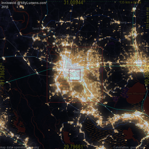
Analysis of Inniswold night lights 2016
Square area 10x10 km:
 67.4%
67.4%90-99
30.04%80-89
2.56%70-79
0%60-69
0%50-59
0%40-49
0%30-39
0%20-29
0%10-19
0%0-9
0%Square area 50x50 km:
11.64%90-99
9.02%80-89
10.22%70-79
11.02%60-69
12.23%50-59
7.18%40-49
8.97%30-39
6.52%20-29
6.51%10-19
6.41%0-9
10.28%Clear (daylight) street map image can be seen on geolist.org.
Map coordinates:
31° 0' 34" North, 91° 47' 11.7" West
30° 24' 17.7" North, 91° 5' 0.4" West
29° 47' 47.8" North, 90° 22' 49.2" West
Some cities around Inniswold sort by population:
• Baton Rouge
10.9 km =6.8 mi,  293°
293°
• Shenandoah
7.9 km =4.9 mi,  92°
92°
• Gardere
8.5 km =5.3 mi,  219°
219°
• Merrydale
11 km =6.8 mi,  347°
347°
• Oak Hills Place
5 km =3.1 mi,  184°
184°
• Village Saint George
5 km =3.1 mi,  161°
161°
• Old Jefferson
6.8 km =4.2 mi,  111°
111°
• Monticello
9.9 km =6.2 mi,  19°
19°
4328435 (p: 6,180)
Sources (retrieved 2019-11-25):
» Earth at Night: Flat Maps 2012, 2016