Indianola night lights from space
Night Light of Indianola (Mississippi) from space (United States) Src. Average luminocity for 10x10km area is 24.7378% and for 50x50km: 2.3647%.
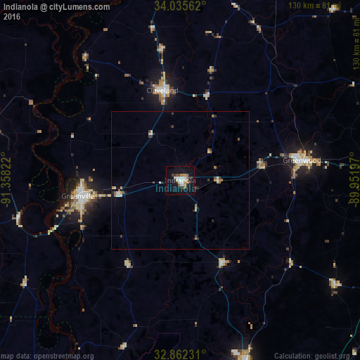
Analysis of Indianola night lights 2016
Square area 10x10 km:
 5.07%
5.07%90-99
5.24%80-89
1.4%70-79
2.1%60-69
3.5%50-59
2.1%40-49
3.32%30-39
1.75%20-29
2.1%10-19
26.4%0-9
47.03%Square area 50x50 km:
0.29%90-99
0.48%80-89
0.18%70-79
0.2%60-69
0.38%50-59
0.21%40-49
0.3%30-39
0.34%20-29
0.28%10-19
1.3%0-9
96.03%Clear (daylight) street map image can be seen on geolist.org.
Map coordinates:
34° 2' 8.2" North, 91° 21' 29.6" West
33° 27' 3.4" North, 90° 39' 18.3" West
32° 51' 44.3" North, 89° 57' 7.1" West
Some cities around Indianola sort by population:
• Greenville
37.8 km =23.5 mi,  262°
262°
• Clarksdale
83.7 km =52 mi,  5°
5°
• Greenwood
44.7 km =27.8 mi,  80°
80°
• Grenada
86 km =53.4 mi,  65°
65°
• Cleveland
33.2 km =20.6 mi,  348°
348°
• Yazoo City
70.2 km =43.6 mi,  160°
160°
• Monticello
107.1 km =66.5 mi,  280°
280°
• Kosciusko
108.3 km =67.3 mi,  113°
113°
4430981 (p: 9,943)
Sources (retrieved 2019-11-25):
» Earth at Night: Flat Maps 2012, 2016