Hillsboro night lights from space
Night Light of Hillsboro (Oregon) from space (United States) Src. Average luminocity for 10x10km area is 47.9939% and for 50x50km: 24.1265%.
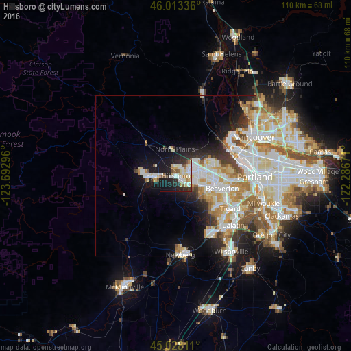
Analysis of Hillsboro night lights 2016
Square area 10x10 km:
 11.36%
90-99
12.12%80-89
8.79%70-79
1.52%60-69
4.7%50-59
4.09%40-49
2.73%30-39
3.48%20-29
17.12%10-19
29.24%0-9
4.85%Square area 50x50 km:
6.14%90-99
6.17%80-89
2.72%70-79
3.19%60-69
2.88%50-59
2.01%40-49
1.7%30-39
2.43%20-29
4.41%10-19
8.29%0-9
60.06%Clear (daylight) street map image can be seen on geolist.org.
Map coordinates:
46° 0' 48.1" North, 123° 41' 34.7" West
45° 31' 22.4" North, 122° 59' 23.4" West
45° 1' 41.2" North, 122° 17' 12.2" West
Some cities around Hillsboro sort by population:
• Aloha
10.1 km =6.3 mi,  108°
108°
• Forest Grove
9.4 km =5.8 mi,  267°
267°
• Bethany
10.3 km =6.4 mi,  67°
67°
• Cedar Mill
13.9 km =8.6 mi,  89°
89°
• Cornelius
5.5 km =3.4 mi, 266°
• Oak Hills
11.8 km =7.3 mi,  80°
80°
• Rockcreek
9.3 km =5.8 mi, 70°
• Cedar Hills
15 km =9.3 mi,  97°
97°
5731371 (p: 102,347)
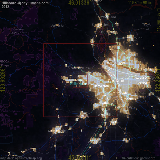
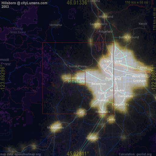
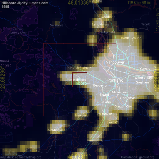
Sources (retrieved 2019-11-25):
» NASA, Earths city lights 1995
» NASA city lights 2003
» Earth at Night: Flat Maps 2012, 2016