Hernando night lights from space
Night Light of Hernando (Mississippi) from space (United States) Src. Average luminocity for 10x10km area is 41.7656% and for 50x50km: 26.9994%.
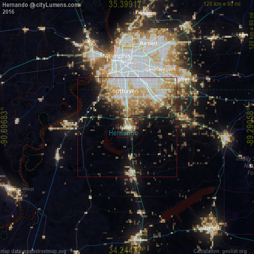
Analysis of Hernando night lights 2016
Square area 10x10 km:
 3.11%
3.11%90-99
5.13%80-89
7.51%70-79
5.13%60-69
7.51%50-59
9.52%40-49
4.95%30-39
12.64%20-29
11.72%10-19
24.36%0-9
8.42%Square area 50x50 km:
5.18%90-99
5.42%80-89
4.35%70-79
3.97%60-69
3.58%50-59
3.46%40-49
3.22%30-39
3.89%20-29
3.88%10-19
7.66%0-9
55.38%Clear (daylight) street map image can be seen on geolist.org.
Map coordinates:
35° 23' 57" North, 90° 41' 48.6" West
34° 49' 26.4" North, 89° 59' 37.3" West
34° 14' 41.2" North, 89° 17' 26.1" West
Some cities around Hernando sort by population:
• Memphis
36.5 km =22.7 mi,  352°
352°
• New South Memphis
29.8 km =18.5 mi, 348°
• Southaven
18.4 km =11.4 mi, 354°
• Collierville
38.6 km =24 mi,  51°
51°
• Germantown
33.7 km =20.9 mi,  29°
29°
• Olive Branch
21.4 km =13.3 mi,  44°
44°
• Horn Lake
15.1 km =9.4 mi, 345°
• Senatobia
23.1 km =14.4 mi,  174°
174°
4429589 (p: 15,503)
Sources (retrieved 2019-11-25):
» Earth at Night: Flat Maps 2012, 2016