New South Memphis night lights from space
Night Light of New South Memphis (Tennessee) from space (United States) Src. Average luminocity for 10x10km area is 94.3671% and for 50x50km: 54.0624%.
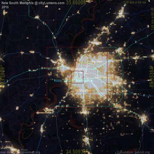
Analysis of New South Memphis night lights 2016
Square area 10x10 km:
 54.37%
90-99
27.45%80-89
3.85%70-79
8.22%60-69
4.55%50-59
0.87%40-49
0.7%30-39
0%20-29
0%10-19
0%0-9
0%Square area 50x50 km:
18.83%90-99
12.65%80-89
7.18%70-79
5.89%60-69
5.27%50-59
4.42%40-49
4.01%30-39
4.87%20-29
6.06%10-19
7.83%0-9
22.99%Clear (daylight) street map image can be seen on geolist.org.
Map coordinates:
35° 39' 36.3" North, 90° 45' 35.6" West
35° 5' 12.3" North, 90° 3' 24.3" West
34° 30' 33.8" North, 89° 21' 13.1" West
Some cities around New South Memphis sort by population:
• Memphis
7 km =4.3 mi,  5°
5°
• Bartlett
21.2 km =13.2 mi,  51°
51°
• Southaven
11.6 km =7.2 mi,  159°
159°
• Germantown
22.4 km =13.9 mi,  90°
90°
• Olive Branch
24.9 km =15.5 mi,  123°
123°
• Horn Lake
14.7 km =9.1 mi,  172°
172°
• West Memphis
13.4 km =8.3 mi,  299°
299°
• Marion
19.1 km =11.9 mi,  318°
318°
4645421 (p: 641,608)
Sources (retrieved 2019-11-25):
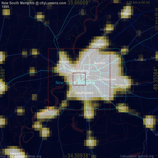
» NASA, Earths city lights 1995
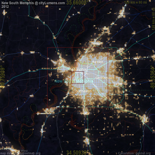
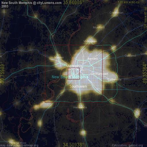
» NASA city lights 2003
» Earth at Night: Flat Maps 2012, 2016