Helotes night lights from space
Night Light of Helotes (Texas) from space (United States) Src. Average luminocity for 10x10km area is 54.197% and for 50x50km: 40.9084%.
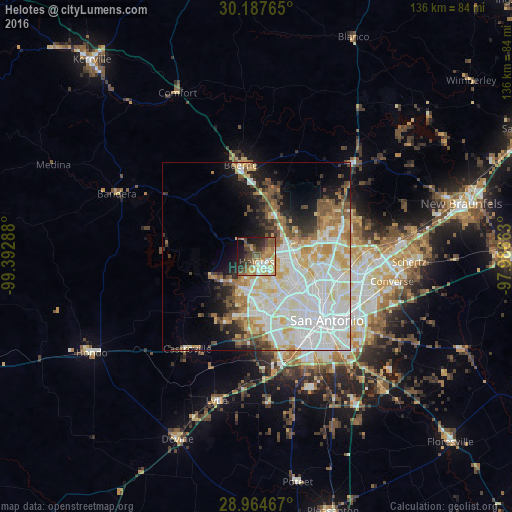
Analysis of Helotes night lights 2016
Square area 10x10 km:
 7.01%
7.01%90-99
6.63%80-89
7.01%70-79
14.02%60-69
4.55%50-59
16.29%40-49
11.55%30-39
9.28%20-29
11.17%10-19
10.98%0-9
1.52%Square area 50x50 km:
12.65%90-99
11.03%80-89
5.2%70-79
4.79%60-69
3.6%50-59
4.2%40-49
3.08%30-39
2.9%20-29
3.85%10-19
7.42%0-9
41.29%Clear (daylight) street map image can be seen on geolist.org.
Map coordinates:
30° 11' 15.5" North, 99° 23' 34.4" West
29° 34' 40.8" North, 98° 41' 23.1" West
28° 57' 52.8" North, 97° 59' 11.9" West
Some cities around Helotes sort by population:
• San Antonio
25.6 km =15.9 mi,  132°
132°
• Boerne
24.4 km =15.2 mi,  350°
350°
• Timberwood Park
24.9 km =15.5 mi,  55°
55°
• Leon Valley
11.5 km =7.1 mi,  143°
143°
• Lackland Air Force Base
22.4 km =13.9 mi,  161°
161°
• Alamo Heights
24 km =14.9 mi,  115°
115°
• Fair Oaks Ranch
19.2 km =11.9 mi,  13°
13°
• Lakehills
24.7 km =15.3 mi,  276°
276°
4697038 (p: 8,591)
Sources (retrieved 2019-11-25):
» Earth at Night: Flat Maps 2012, 2016