Hanford night lights from space
Night Light of Hanford (California) from space (United States) Src. Average luminocity for 10x10km area is 42.4458% and for 50x50km: 8.3263%.
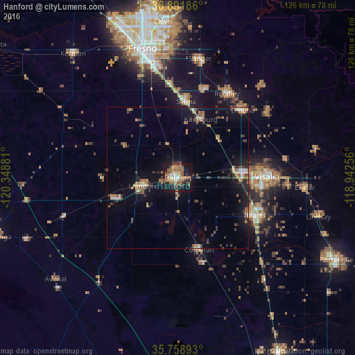

Analysis of Hanford night lights 2016
Square area 10x10 km:
 3.15%
3.15%90-99
4.37%80-89
3.5%70-79
7.69%60-69
13.29%50-59
12.94%40-49
5.59%30-39
6.64%20-29
4.55%10-19
33.92%0-9
4.37%Square area 50x50 km:
0.42%90-99
0.7%80-89
0.51%70-79
1.26%60-69
1.42%50-59
1.57%40-49
1.59%30-39
2%20-29
1.53%10-19
7.41%0-9
81.58%Clear (daylight) street map image can be seen on geolist.org.
Map coordinates:
36° 53' 30.7" North, 120° 20' 55.7" West
36° 19' 38.8" North, 119° 38' 44.4" West
35° 45' 32.1" North, 118° 56' 33.2" West
Some cities around Hanford sort by population:
• Visalia
31.7 km =19.7 mi,  89°
89°
• Tulare
29.9 km =18.6 mi,  116°
116°
• Lemoore
12.6 km =7.8 mi,  256°
256°
• Selma
27.2 km =16.9 mi,  6°
6°
• Corcoran
26.6 km =16.5 mi,  163°
163°
• Parlier
33.3 km =20.7 mi,  18°
18°
• Kingsburg
22.3 km =13.9 mi, 21°
• Lemoore Station
24.3 km =15.1 mi,  252°
252°
5355180 (p: 55,659)
Sources (retrieved 2019-11-25):
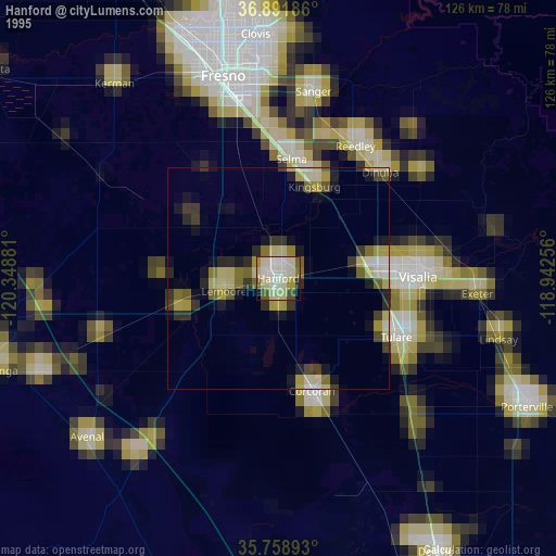
» NASA, Earths city lights 1995
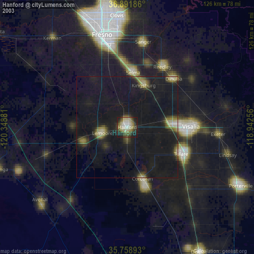
» NASA city lights 2003
» Earth at Night: Flat Maps 2012, 2016