Visalia night lights from space
Night Light of Visalia (California) from space (United States) Src. Average luminocity for 10x10km area is 60.1469% and for 50x50km: 12.5444%.
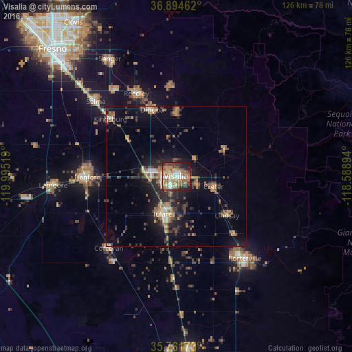

Analysis of Visalia night lights 2016
Square area 10x10 km:
 8.74%
8.74%90-99
10.66%80-89
6.29%70-79
8.04%60-69
18.53%50-59
14.86%40-49
8.74%30-39
4.37%20-29
13.29%10-19
6.47%0-9
0%Square area 50x50 km:
0.78%90-99
1.07%80-89
0.87%70-79
2.04%60-69
2.49%50-59
2.45%40-49
2.41%30-39
2.72%20-29
3.66%10-19
8.41%0-9
73.11%Clear (daylight) street map image can be seen on geolist.org.
Map coordinates:
36° 53' 40.6" North, 119° 59' 42.7" West
36° 19' 48.8" North, 119° 17' 31.4" West
35° 45' 42.2" North, 118° 35' 20.2" West
Some cities around Visalia sort by population:
• Tulare
14.5 km =9 mi,  199°
199°
• Dinuba
25.2 km =15.7 mi,  340°
340°
• Lindsay
23.1 km =14.4 mi,  127°
127°
• Kingsburg
31.1 km =19.3 mi,  311°
311°
• Farmersville
8.5 km =5.3 mi,  115°
115°
• Exeter
14 km =8.7 mi,  105°
105°
• Orosi
23.9 km =14.9 mi,  1°
1°
• Woodlake
19.6 km =12.2 mi,  61°
61°
5406567 (p: 130,104)
Sources (retrieved 2019-11-25):
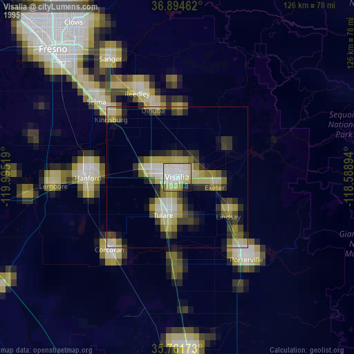
» NASA, Earths city lights 1995
» NASA city lights 2003
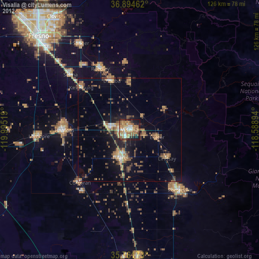
» Earth at Night: Flat Maps 2012, 2016