Hampshire night lights from space
Night Light of Hampshire (Illinois) from space (United States) Src. Average luminocity for 10x10km area is 16.0545% and for 50x50km: 30.6388%.
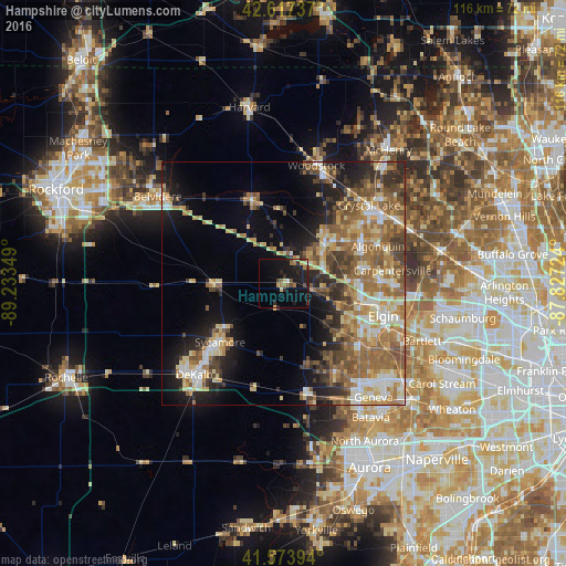
Analysis of Hampshire night lights 2016
Square area 10x10 km:
 0.3%
0.3%90-99
0.61%80-89
2.73%70-79
1.36%60-69
3.33%50-59
1.52%40-49
3.48%30-39
1.36%20-29
6.52%10-19
21.82%0-9
56.97%Square area 50x50 km:
3.44%90-99
4.31%80-89
5.19%70-79
4.57%60-69
6.51%50-59
6.7%40-49
4.65%30-39
3.57%20-29
5.99%10-19
10.16%0-9
44.91%Clear (daylight) street map image can be seen on geolist.org.
Map coordinates:
42° 37' 2.5" North, 89° 14' 0.6" West
42° 5' 52.1" North, 88° 31' 49.3" West
41° 34' 26.2" North, 87° 49' 38.1" West
Some cities around Hampshire sort by population:
• Lake in the Hills
18.9 km =11.7 mi,  60°
60°
• Huntley
11.5 km =7.1 mi,  47°
47°
• Sycamore
17.7 km =11 mi,  226°
226°
• Gilberts
13 km =8.1 mi,  87°
87°
• Marengo
18 km =11.2 mi,  339°
339°
• West Dundee
20.4 km =12.7 mi, 89°
• Pingree Grove
10.2 km =6.3 mi,  108°
108°
• Genoa
13.4 km =8.3 mi,  269°
269°
4895016 (p: 6,130)
Sources (retrieved 2019-11-25):
» Earth at Night: Flat Maps 2012, 2016