Hamilton Worcester night lights from space
Night Light of Hamilton Worcester (Massachusetts) from space (United States) Src. Average luminocity for 10x10km area is 83.7152% and for 50x50km: 26.8035%.
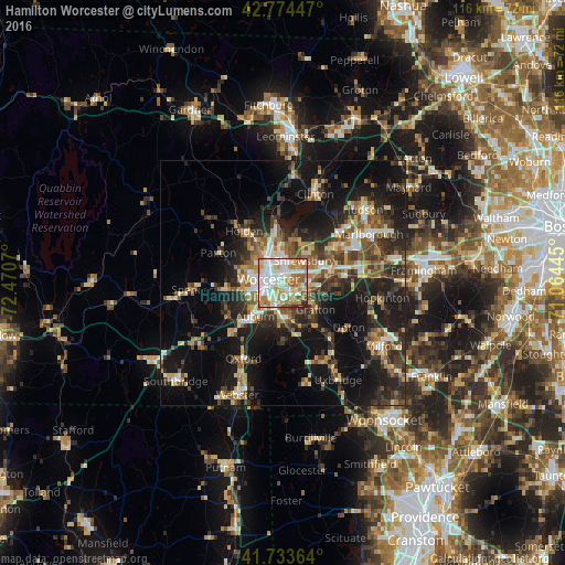
Analysis of Hamilton Worcester night lights 2016
Square area 10x10 km:
 25.45%
90-99
27.42%80-89
8.48%70-79
13.79%60-69
14.39%50-59
6.67%40-49
1.06%30-39
2.12%20-29
0.61%10-19
0%0-9
0%Square area 50x50 km:
2.85%90-99
3.9%80-89
3.41%70-79
3.15%60-69
3.88%50-59
4.26%40-49
4.46%30-39
5.13%20-29
9.49%10-19
19.62%0-9
39.83%Clear (daylight) street map image can be seen on geolist.org.
Map coordinates:
42° 46' 28.1" North, 72° 28' 14.5" West
42° 15' 22.3" North, 71° 46' 3.3" West
41° 44' 1.1" North, 71° 3' 52" West
Some cities around Hamilton Worcester sort by population:
• Worcester
2.9 km =1.8 mi,  283°
283°
• Shrewsbury
6.3 km =3.9 mi,  45°
45°
• Auburn
8.9 km =5.5 mi,  219°
219°
• Grafton
8.7 km =5.4 mi,  129°
129°
• Millbury
6.9 km =4.3 mi,  174°
174°
• Leicester
11.7 km =7.3 mi,  264°
264°
• Sutton
11.8 km =7.3 mi,  178°
178°
• West Boylston
12.4 km =7.7 mi,  353°
353°
4938697 (p: 8,460)
Sources (retrieved 2019-11-25):
» Earth at Night: Flat Maps 2012, 2016