Green Knoll night lights from space
Night Light of Green Knoll (New Jersey) from space (United States) Src. Average luminocity for 10x10km area is 65.625% and for 50x50km: 43.845%.
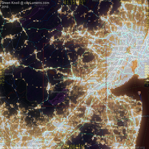
Analysis of Green Knoll night lights 2016
Square area 10x10 km:
 10.71%
90-99
14.77%80-89
5.36%70-79
9.42%60-69
11.36%50-59
19.81%40-49
15.91%30-39
8.44%20-29
4.22%10-19
0%0-9
0%Square area 50x50 km:
6.63%90-99
7.9%80-89
5.88%70-79
8.59%60-69
8.77%50-59
7.44%40-49
5.75%30-39
5.46%20-29
6.58%10-19
11.08%0-9
25.92%Clear (daylight) street map image can be seen on geolist.org.
Map coordinates:
41° 7' 54.6" North, 75° 18' 54.8" West
40° 36' 0.4" North, 74° 36' 43.6" West
40° 3' 50.8" North, 73° 54' 32.3" West
Some cities around Green Knoll sort by population:
• Bridgewater
3 km =1.9 mi,  271°
271°
• Bradley Gardens
5.5 km =3.4 mi,  220°
220°
• Somerville
2.9 km =1.8 mi,  176°
176°
• Martinsville
4.5 km =2.8 mi,  88°
88°
• Bound Brook
7.1 km =4.4 mi,  119°
119°
• Manville
6.9 km =4.3 mi,  162°
162°
• Raritan
3.8 km =2.4 mi,  207°
207°
• Finderne
5 km =3.1 mi,  144°
144°
5098617 (p: 6,200)
Sources (retrieved 2019-11-25):
» Earth at Night: Flat Maps 2012, 2016