Glencoe night lights from space
Night Light of Glencoe (Alabama) from space (United States) Src. Average luminocity for 10x10km area is 41.7413% and for 50x50km: 14.8992%.
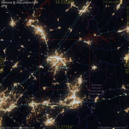
Analysis of Glencoe night lights 2016
Square area 10x10 km:
 2.27%
2.27%90-99
3.85%80-89
6.64%70-79
6.82%60-69
8.74%50-59
8.22%40-49
10.49%30-39
10.84%20-29
12.06%10-19
22.9%0-9
7.17%Square area 50x50 km:
1.15%90-99
1.16%80-89
2.16%70-79
2.46%60-69
2.6%50-59
2.07%40-49
2.83%30-39
4.27%20-29
4.36%10-19
8.66%0-9
68.28%Clear (daylight) street map image can be seen on geolist.org.
Map coordinates:
34° 32' 17.7" North, 86° 38' 8.2" West
33° 57' 25.3" North, 85° 55' 56.9" West
33° 22' 18.6" North, 85° 13' 45.7" West
Some cities around Glencoe sort by population:
• Gadsden
9.3 km =5.8 mi,  313°
313°
• Anniston
34.3 km =21.3 mi,  164°
164°
• Jacksonville
22.4 km =13.9 mi,  135°
135°
• Saks
30 km =18.6 mi, 163°
• Boaz
34.6 km =21.5 mi,  321°
321°
• Rainbow City
10.1 km =6.3 mi,  268°
268°
• Southside
9.1 km =5.7 mi,  246°
246°
• Attalla
16.1 km =10 mi,  296°
296°
4064310 (p: 5,153)
Sources (retrieved 2019-11-25):
» Earth at Night: Flat Maps 2012, 2016