Glassboro night lights from space
Night Light of Glassboro (New Jersey) from space (United States) Src. Average luminocity for 10x10km area is 56.5292% and for 50x50km: 44.9042%.
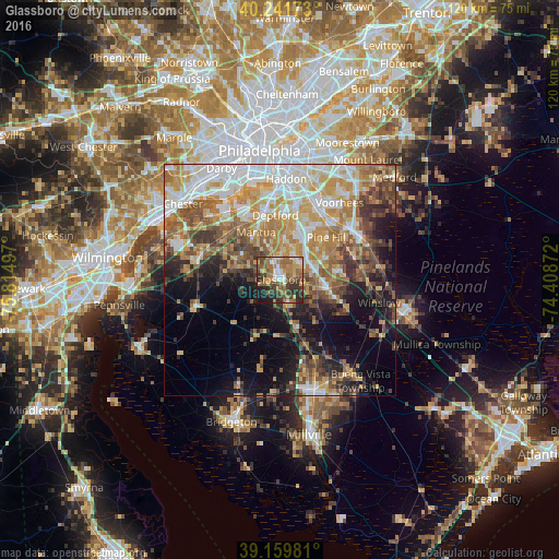
Analysis of Glassboro night lights 2016
Square area 10x10 km:
 6.17%
6.17%90-99
8.28%80-89
5.52%70-79
8.93%60-69
20.13%50-59
11.69%40-49
6.66%30-39
14.45%20-29
10.23%10-19
7.79%0-9
0.16%Square area 50x50 km:
8.82%90-99
8.15%80-89
5.99%70-79
8.35%60-69
7.6%50-59
6.2%40-49
6.38%30-39
5.81%20-29
5.64%10-19
11.21%0-9
25.85%Clear (daylight) street map image can be seen on geolist.org.
Map coordinates:
40° 14' 30.2" North, 75° 48' 53.9" West
39° 42' 10.4" North, 75° 6' 42.6" West
39° 9' 35.3" North, 74° 24' 31.4" West
Some cities around Glassboro sort by population:
• Sicklerville
12.3 km =7.6 mi,  82°
82°
• Lindenwold
16.7 km =10.4 mi,  35°
35°
• Williamstown
10.2 km =6.3 mi,  100°
100°
• Pine Hill
13.7 km =8.5 mi,  48°
48°
• Woodbury
15.4 km =9.6 mi,  346°
346°
• Pitman
3.7 km =2.3 mi,  333°
333°
• Clayton
5 km =3.1 mi,  160°
160°
• Stratford
16.1 km =10 mi,  30°
30°
4501931 (p: 19,216)
Sources (retrieved 2019-11-25):
» Earth at Night: Flat Maps 2012, 2016