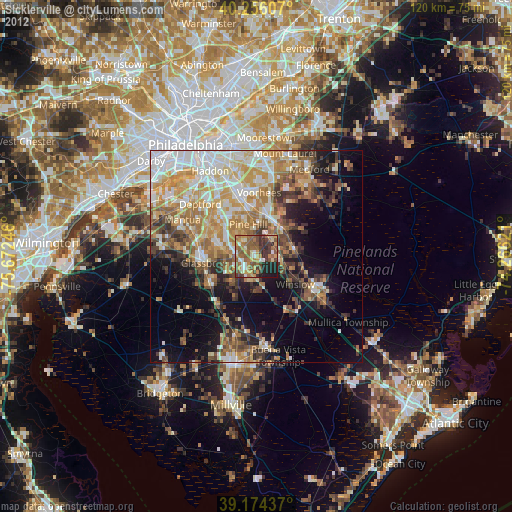
Sicklerville night lights from space
Night Light of Sicklerville (New Jersey) from space (United States) Src. Average luminocity for 10x10km area is 57.9253% and for 50x50km: 40.0714%.
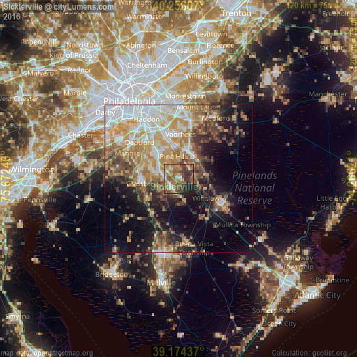
Analysis of Sicklerville night lights 2016
Square area 10x10 km:
 4.55%
4.55%90-99
7.63%80-89
6.66%70-79
10.39%60-69
17.37%50-59
17.21%40-49
12.18%30-39
11.85%20-29
7.95%10-19
4.22%0-9
0%Square area 50x50 km:
7.87%90-99
6.69%80-89
5.24%70-79
7.57%60-69
6.57%50-59
5.02%40-49
5.8%30-39
5.74%20-29
5.56%10-19
12.6%0-9
31.34%Clear (daylight) street map image can be seen on geolist.org.
Map coordinates:
40° 15' 21.9" North, 75° 40' 20.9" West
39° 43' 2.4" North, 74° 58' 9.6" West
39° 10' 27.7" North, 74° 15' 58.4" West
Some cities around Sicklerville sort by population:
• Jackson
11.3 km =7 mi,  54°
54°
• Glassboro
12.3 km =7.6 mi,  262°
262°
• Lindenwold
12.1 km =7.5 mi,  348°
348°
• Williamstown
4.1 km =2.5 mi,  212°
212°
• Atco
9.1 km =5.7 mi, 50°
• Pine Hill
7.7 km =4.8 mi, 345°
• Clayton
12.3 km =7.6 mi,  238°
238°
• Berlin
8.9 km =5.5 mi,  22°
22°
4504118 (p: 42,891)
Sources (retrieved 2019-11-25):
» Earth at Night: Flat Maps 2012, 2016