Bloomingdale night lights from space
Night Light of Bloomingdale (Florida) from space (United States) Src. Average luminocity for 10x10km area is 75.9337% and for 50x50km: 51.1979%.

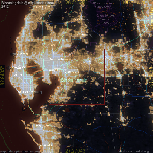
Analysis of Bloomingdale night lights 2016
Square area 10x10 km:
 9.85%
9.85%90-99
16.29%80-89
18.75%70-79
15.53%60-69
23.67%50-59
7.39%40-49
6.25%30-39
2.27%20-29
0%10-19
0%0-9
0%Square area 50x50 km:
10.97%90-99
9.35%80-89
5.18%70-79
6.97%60-69
15.31%50-59
7.94%40-49
5.4%30-39
4.86%20-29
6.97%10-19
8.24%0-9
18.81%Clear (daylight) street map image can be seen on geolist.org.
Map coordinates:
28° 30' 47.8" North, 82° 56' 36.6" West
27° 53' 37.1" North, 82° 14' 25.3" West
27° 16' 13.5" North, 81° 32' 14.1" West
Some cities around Bloomingdale sort by population:
• Brandon
6.6 km =4.1 mi,  317°
317°
• Riverview
9 km =5.6 mi,  250°
250°
• Valrico
4.9 km =3 mi,  4°
4°
• Fish Hawk
5.6 km =3.5 mi,  148°
148°
• Mango
11.6 km =7.2 mi,  325°
325°
• Seffner
10.6 km =6.6 mi,  340°
340°
• Boyette
8.6 km =5.3 mi,  168°
168°
• Progress Village
12.2 km =7.6 mi,  273°
273°
4148207 (p: 22,711)
Sources (retrieved 2019-11-25):
» Earth at Night: Flat Maps 2012, 2016