Front Royal night lights from space
Night Light of Front Royal (Virginia) from space (United States) Src. Average luminocity for 10x10km area is 21.7653% and for 50x50km: 4.2414%.
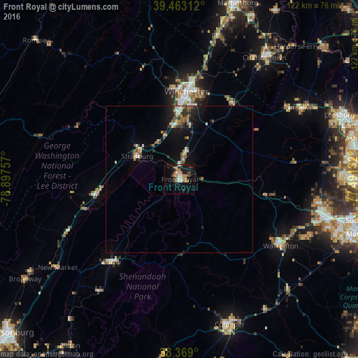
Analysis of Front Royal night lights 2016
Square area 10x10 km:
 2.38%
2.38%90-99
1.36%80-89
2.72%70-79
3.23%60-69
3.57%50-59
5.44%40-49
1.36%30-39
3.57%20-29
4.59%10-19
20.58%0-9
51.19%Square area 50x50 km:
0.4%90-99
0.41%80-89
0.6%70-79
0.35%60-69
0.52%50-59
0.82%40-49
0.53%30-39
0.79%20-29
0.86%10-19
3.49%0-9
91.22%Clear (daylight) street map image can be seen on geolist.org.
Map coordinates:
39° 27' 47.2" North, 78° 53' 51.3" West
38° 55' 5.4" North, 78° 11' 40" West
38° 22' 8.4" North, 77° 29' 28.8" West
Some cities around Front Royal sort by population:
• Winchester
29.9 km =18.6 mi,  5°
5°
• Gainesville
52.1 km =32.4 mi,  105°
105°
• Warrenton
41.4 km =25.7 mi,  123°
123°
• Purcellville
48 km =29.8 mi,  59°
59°
• New Baltimore
43.7 km =27.2 mi, 112°
• Strasburg
16.2 km =10.1 mi,  298°
298°
• Charles Town
50.3 km =31.3 mi,  35°
35°
• Woodstock
27.2 km =16.9 mi,  261°
261°
4760232 (p: 15,070)
Sources (retrieved 2019-11-25):
» Earth at Night: Flat Maps 2012, 2016