Frisco night lights from space
Night Light of Frisco (Texas) from space (United States) Src. Average luminocity for 10x10km area is 92.3333% and for 50x50km: 62.9288%.
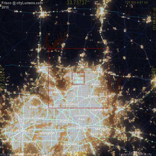
Analysis of Frisco night lights 2016
Square area 10x10 km:
 37.73%
90-99
33.15%80-89
11.9%70-79
14.29%60-69
2.38%50-59
0.55%40-49
0%30-39
0%20-29
0%10-19
0%0-9
0%Square area 50x50 km:
19.78%90-99
17.59%80-89
8.35%70-79
7.56%60-69
7.17%50-59
5.61%40-49
3.91%30-39
3.88%20-29
5.1%10-19
6.18%0-9
14.86%Clear (daylight) street map image can be seen on geolist.org.
Map coordinates:
33° 44' 14.5" North, 97° 31' 36.3" West
33° 9' 2.4" North, 96° 49' 25" West
32° 33' 36.1" North, 96° 7' 13.8" West
Some cities around Frisco sort by population:
• Plano
18.6 km =11.6 mi,  141°
141°
• Allen
15.2 km =9.4 mi,  110°
110°
• The Colony
9 km =5.6 mi,  220°
220°
• Little Elm
10.7 km =6.6 mi,  277°
277°
• Prosper
9.7 km =6 mi,  12°
12°
• Fairview
17.9 km =11.1 mi,  87°
87°
• Lake Dallas
19.1 km =11.9 mi,  259°
259°
• Celina
19.7 km =12.2 mi, 10°
4692559 (p: 154,407)
Sources (retrieved 2019-11-25):
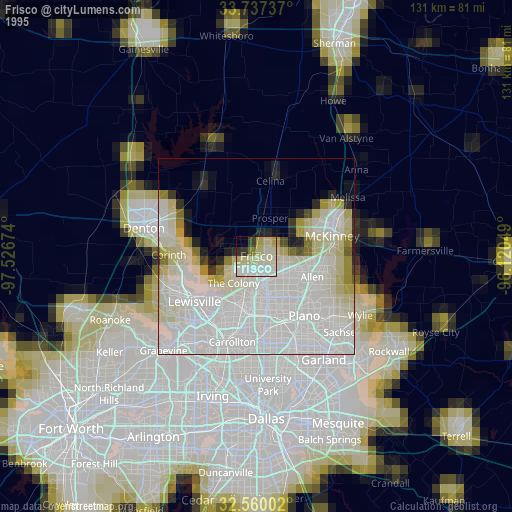
» NASA, Earths city lights 1995
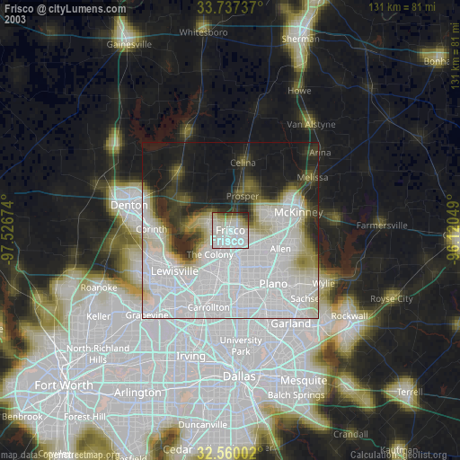
» NASA city lights 2003
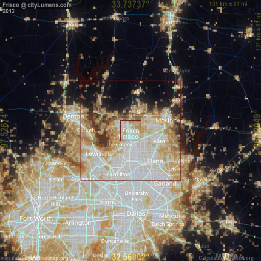
» Earth at Night: Flat Maps 2012, 2016