Fort Hood night lights from space
Night Light of Fort Hood (Texas) from space (United States) Src. Average luminocity for 10x10km area is 72.826% and for 50x50km: 13.328%.
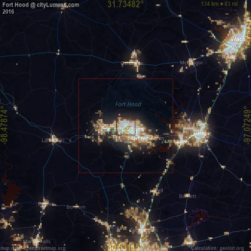
Analysis of Fort Hood night lights 2016
Square area 10x10 km:
 19.41%
90-99
21.79%80-89
8.61%70-79
9.71%60-69
12.64%50-59
2.93%40-49
6.96%30-39
4.95%20-29
12.27%10-19
0.73%0-9
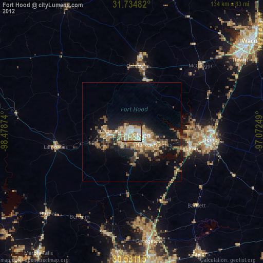
0%Square area 50x50 km:
1.68%90-99
1.94%80-89
1.77%70-79
1.67%60-69
2.5%50-59
1.92%40-49
2.04%30-39
2.23%20-29
3.75%10-19
7.58%0-9
72.93%Clear (daylight) street map image can be seen on geolist.org.
Map coordinates:
31° 44' 5.4" North, 98° 28' 43.5" West
31° 8' 5.6" North, 97° 46' 32.2" West
30° 31' 52.1" North, 97° 4' 21" West
Some cities around Fort Hood sort by population:
• Killeen
5 km =3.1 mi,  113°
113°
• Temple
41.4 km =25.7 mi,  95°
95°
• Copperas Cove
12.2 km =7.6 mi,  264°
264°
• Harker Heights
12.4 km =7.7 mi,  117°
117°
• Belton
30.9 km =19.2 mi, 106°
• Gatesville
33.5 km =20.8 mi,  5°
5°
• Lampasas
39.5 km =24.5 mi, 258°
• McGregor
48.9 km =30.4 mi,  45°
45°
7261291 (p: 29,589)
Sources (retrieved 2019-11-25):
» Earth at Night: Flat Maps 2012, 2016