Florence-Graham night lights from space
Night Light of Florence-Graham (California) from space (United States) Src. Average luminocity for 10x10km area is 100% and for 50x50km: 85.7178%.
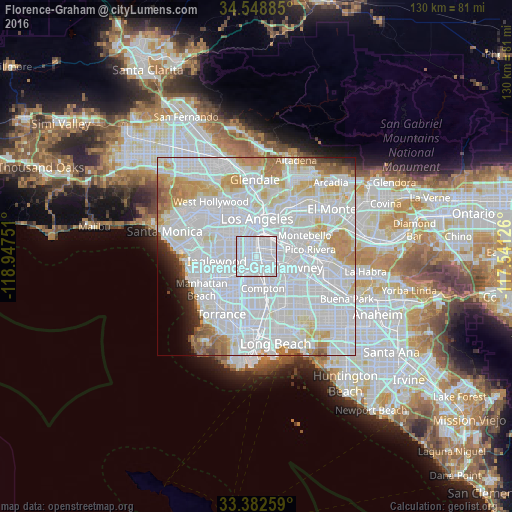
Analysis of Florence-Graham night lights 2016
Square area 10x10 km:
 100%
100%90-99
0%80-89
0%70-79
0%60-69
0%50-59
0%40-49
0%30-39
0%20-29
0%10-19
0%0-9
0%Square area 50x50 km:
50.06%90-99
21.22%80-89
5.75%70-79
5.88%60-69
4.56%50-59
2.18%40-49
1.13%30-39
1.13%20-29
1.48%10-19
1.65%0-9
4.96%Clear (daylight) street map image can be seen on geolist.org.
Map coordinates:
34° 32' 55.9" North, 118° 56' 51" West
33° 58' 3.8" North, 118° 14' 39.8" West
33° 22' 57.3" North, 117° 32' 28.5" West
Some cities around Florence-Graham sort by population:
• South Gate
3.3 km =2.1 mi,  115°
115°
• Lynwood
5.2 km =3.2 mi,  143°
143°
• Huntington Park
2.4 km =1.5 mi,  48°
48°
• Bell
5.4 km =3.4 mi,  78°
78°
• Willowbrook
5.7 km =3.5 mi,  189°
189°
• Maywood
5.8 km =3.6 mi,  68°
68°
• Cudahy
5.5 km =3.4 mi,  98°
98°
• Walnut Park
1.8 km =1.1 mi,  88°
88°
7261268 (p: 63,387)
Sources (retrieved 2019-11-25):
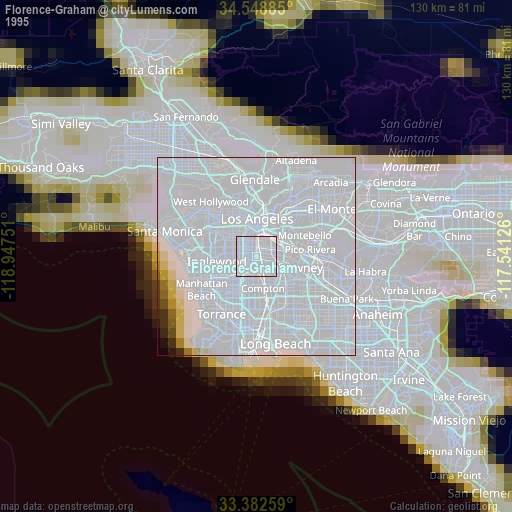
» NASA, Earths city lights 1995
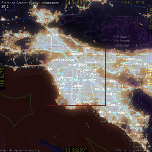
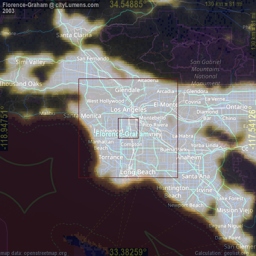
» NASA city lights 2003
» Earth at Night: Flat Maps 2012, 2016