Cudahy night lights from space
Night Light of Cudahy (California) from space (United States) Src. Average luminocity for 10x10km area is 99.8759% and for 50x50km: 90.7687%.
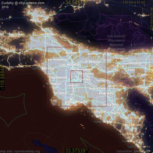

Analysis of Cudahy night lights 2016
Square area 10x10 km:
 89.16%
90-99
10.84%80-89
0%70-79
0%60-69
0%50-59
0%40-49
0%30-39
0%20-29
0%10-19
0%0-9
0%Square area 50x50 km:
52.86%90-99
23.65%80-89
6.12%70-79
6.15%60-69
4.06%50-59
2.14%40-49
1.15%30-39
0.91%20-29
1.1%10-19
0.99%0-9
0.88%Clear (daylight) street map image can be seen on geolist.org.
Map coordinates:
34° 32' 30.3" North, 118° 53' 18.5" West
33° 57' 38.1" North, 118° 11' 7.3" West
33° 22' 31.4" North, 117° 28' 56" West
Some cities around Cudahy sort by population:
• South Gate
2.5 km =1.6 mi,  255°
255°
• Lynwood
4.1 km =2.5 mi,  215°
215°
• Huntington Park
4.4 km =2.7 mi,  302°
302°
• Bell Gardens
3.2 km =2 mi,  80°
80°
• Bell
1.9 km =1.2 mi,  355°
355°
• Maywood
2.9 km =1.8 mi,  0°
0°
• Walnut Park
3.8 km =2.4 mi,  282°
282°
• Commerce
5 km =3.1 mi,  27°
27°
5341051 (p: 24,311)
Sources (retrieved 2019-11-25):
» Earth at Night: Flat Maps 2012, 2016