Fairfield night lights from space
Night Light of Fairfield (New Jersey) from space (United States) Src. Average luminocity for 10x10km area is 75.6276% and for 50x50km: 65.084%.
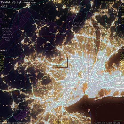
Analysis of Fairfield night lights 2016
Square area 10x10 km:
 15.65%
90-99
14.29%80-89
10.03%70-79
23.13%60-69
12.41%50-59
13.95%40-49
9.52%30-39
1.02%20-29
0%10-19
0%0-9
0%Square area 50x50 km:
21.42%90-99
13.62%80-89
7.52%70-79
9.67%60-69
11.8%50-59
6.84%40-49
4.26%30-39
3.65%20-29
5.15%10-19
5.45%0-9
10.63%Clear (daylight) street map image can be seen on geolist.org.
Map coordinates:
41° 24' 47.4" North, 75° 0' 32.8" West
40° 53' 1.4" North, 74° 18' 21.5" West
40° 20' 60" North, 73° 36' 10.3" West
Some cities around Fairfield sort by population:
• Wayne
5.3 km =3.3 mi,  28°
28°
• Verona
8.2 km =5.1 mi,  137°
137°
• Cedar Grove
7.4 km =4.6 mi,  118°
118°
• Totowa
8.4 km =5.2 mi,  73°
73°
• Lincoln Park
4.5 km =2.8 mi,  4°
4°
• Caldwell
5.5 km =3.4 mi,  153°
153°
• North Caldwell
4.5 km =2.8 mi, 117°
• Roseland
7.1 km =4.4 mi,  171°
171°
5097778 (p: 7,063)
Sources (retrieved 2019-11-25):
» Earth at Night: Flat Maps 2012, 2016