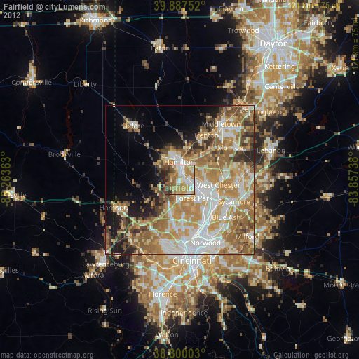
Fairfield night lights from space
Night Light of Fairfield (Ohio) from space (United States) Src. Average luminocity for 10x10km area is 74.3724% and for 50x50km: 49.8128%.

Analysis of Fairfield night lights 2016
Square area 10x10 km:
 13.27%
90-99
17.35%80-89
16.16%70-79
18.2%60-69
9.52%50-59
8.33%40-49
8.84%30-39
5.78%20-29
2.55%10-19
0%0-9
0%Square area 50x50 km:
9.71%90-99
10.73%80-89
6.73%70-79
9.55%60-69
9.51%50-59
7.89%40-49
4.62%30-39
4.93%20-29
4.8%10-19
7.43%0-9
24.1%Clear (daylight) street map image can be seen on geolist.org.
Map coordinates:
39° 53' 15.1" North, 85° 15' 49.1" West
39° 20' 45.2" North, 84° 33' 37.8" West
38° 48' 0.1" North, 83° 51' 26.6" West
Some cities around Fairfield sort by population:
• Hamilton
6 km =3.7 mi,  359°
359°
• Forest Park
7.9 km =4.9 mi,  141°
141°
• Springdale
9.2 km =5.7 mi, 135°
• Northbrook
11.2 km =7 mi,  190°
190°
• Beckett Ridge
10.8 km =6.7 mi,  89°
89°
• Northgate
10.7 km =6.6 mi, 194°
• Mount Healthy
12.5 km =7.8 mi,  174°
174°
• New Burlington
9.6 km =6 mi,  178°
178°
4511283 (p: 42,767)
Sources (retrieved 2019-11-25):
» Earth at Night: Flat Maps 2012, 2016