Eaton night lights from space
Night Light of Eaton (Ohio) from space (United States) Src. Average luminocity for 10x10km area is 18.8506% and for 50x50km: 8.914%.
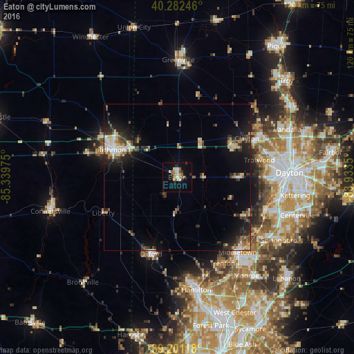
Analysis of Eaton night lights 2016
Square area 10x10 km:
 1.62%
1.62%90-99
4.22%80-89
1.62%70-79
2.27%60-69
2.44%50-59
3.57%40-49
1.62%30-39
1.46%20-29
2.11%10-19
12.99%0-9
66.07%Square area 50x50 km:
0.89%90-99
1.3%80-89
1.2%70-79
0.9%60-69
0.83%50-59
1.04%40-49
1.36%30-39
1.95%20-29
2.88%10-19
6.32%0-9
81.33%Clear (daylight) street map image can be seen on geolist.org.
Map coordinates:
40° 16' 56.9" North, 85° 20' 23.1" West
39° 44' 38.2" North, 84° 38' 11.8" West
39° 12' 4.2" North, 83° 56' 0.6" West
Some cities around Eaton sort by population:
• Richmond
23.6 km =14.7 mi,  293°
293°
• Trotwood
28.4 km =17.6 mi,  77°
77°
• Oxford
27.9 km =17.3 mi,  199°
199°
• Miamisburg
32 km =19.9 mi,  110°
110°
• Englewood
32.2 km =20 mi,  62°
62°
• Clayton
27.1 km =16.8 mi, 60°
• Brookville
21.8 km =13.5 mi, 61°
• Germantown
26.4 km =16.4 mi,  119°
119°
4510719 (p: 8,217)
Sources (retrieved 2019-11-25):
» Earth at Night: Flat Maps 2012, 2016