Easley night lights from space
Night Light of Easley (South Carolina) from space (United States) Src. Average luminocity for 10x10km area is 60.5037% and for 50x50km: 31.9836%.
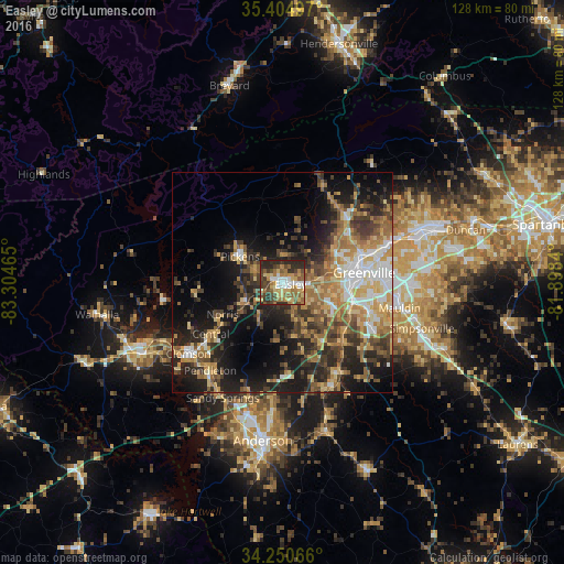
Analysis of Easley night lights 2016
Square area 10x10 km:
 7.88%
7.88%90-99
8.24%80-89
14.1%70-79
8.24%60-69
12.09%50-59
10.26%40-49
13.55%30-39
9.52%20-29
16.12%10-19
0%0-9
0%Square area 50x50 km:
3.72%90-99
3.7%80-89
5.52%70-79
5.03%60-69
5.99%50-59
4.84%40-49
5.13%30-39
6.94%20-29
9.18%10-19
14.61%0-9
35.36%Clear (daylight) street map image can be seen on geolist.org.
Map coordinates:
35° 24' 17.9" North, 83° 18' 16.7" West
34° 49' 47.4" North, 82° 36' 5.5" West
34° 15' 2.4" North, 81° 53' 54.2" West
Some cities around Easley sort by population:
• Greenville
19.1 km =11.9 mi,  82°
82°
• Berea
14.6 km =9.1 mi,  65°
65°
• Gantt
16.5 km =10.3 mi,  101°
101°
• Parker
13.7 km =8.5 mi, 80°
• Sans Souci
17.1 km =10.6 mi, 71°
• Powdersville
10.8 km =6.7 mi,  113°
113°
• Welcome
14.8 km =9.2 mi,  91°
91°
• Piedmont
18.9 km =11.7 mi,  138°
138°
4577263 (p: 20,765)
Sources (retrieved 2019-11-25):
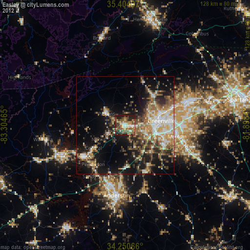
» Earth at Night: Flat Maps 2012, 2016