Palm Desert night lights from space
Night Light of Palm Desert (California) from space (United States) Src. Average luminocity for 10x10km area is 67.5714% and for 50x50km: 19.1372%.
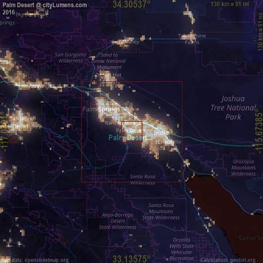
Analysis of Palm Desert night lights 2016
Square area 10x10 km:
 12.64%
90-99
11.54%80-89
10.81%70-79
15.75%60-69
14.84%50-59
9.71%40-49
6.04%30-39
6.04%20-29
9.71%10-19
2.93%0-9
0%Square area 50x50 km:
2.64%90-99
3.27%80-89
2.13%70-79
2.58%60-69
4.51%50-59
3.23%40-49
2.17%30-39
2.35%20-29
4.91%10-19
9.4%0-9
62.8%Clear (daylight) street map image can be seen on geolist.org.
Map coordinates:
34° 18' 19.3" North, 117° 4' 48.4" West
33° 43' 21.2" North, 116° 22' 37.1" West
33° 8' 8.7" North, 115° 40' 25.9" West
Some cities around Palm Desert sort by population:
• Indio
14.8 km =9.2 mi,  90°
90°
• Cathedral City
10.3 km =6.4 mi,  307°
307°
• Coachella
19.4 km =12.1 mi,  104°
104°
• La Quinta
9 km =5.6 mi,  136°
136°
• Rancho Mirage
3.8 km =2.4 mi,  299°
299°
• Thousand Palms
10.9 km =6.8 mi,  353°
353°
• Bermuda Dunes
8.4 km =5.2 mi,  74°
74°
• Indian Wells
3.2 km =2 mi, 99°
5380626 (p: 51,869)
Sources (retrieved 2019-11-25):
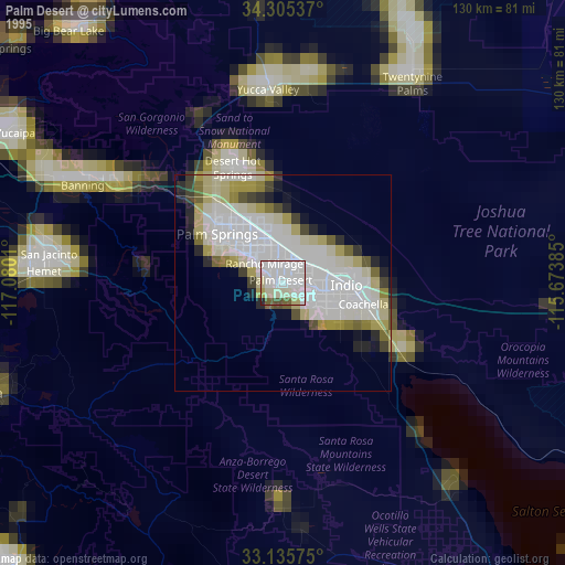
» NASA, Earths city lights 1995
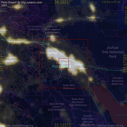
» NASA city lights 2003
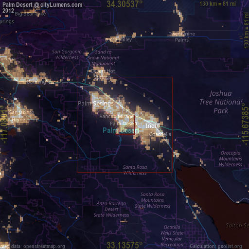
» Earth at Night: Flat Maps 2012, 2016