Cumberland night lights from space
Night Light of Cumberland (Maryland) from space (United States) Src. Average luminocity for 10x10km area is 44.0179% and for 50x50km: 5.0735%.
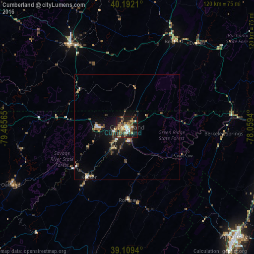
Analysis of Cumberland night lights 2016
Square area 10x10 km:
 5.03%
5.03%90-99
4.55%80-89
8.28%70-79
5.52%60-69
6.17%50-59
11.85%40-49
8.6%30-39
4.55%20-29
15.58%10-19
25%0-9
4.87%Square area 50x50 km:
0.49%90-99
0.38%80-89
0.89%70-79
0.48%60-69
0.54%50-59
0.96%40-49
0.89%30-39
0.95%20-29
1.44%10-19
3.62%0-9
89.37%Clear (daylight) street map image can be seen on geolist.org.
Map coordinates:
40° 11' 31.6" North, 79° 27' 56.3" West
39° 39' 10.3" North, 78° 45' 45.1" West
39° 6' 33.8" North, 78° 3' 33.8" West
Some cities around Cumberland sort by population:
• Winchester
73.1 km =45.4 mi,  135°
135°
• Johnstown
76.1 km =47.3 mi,  349°
349°
• Martinsburg
71.9 km =44.7 mi,  107°
107°
• Frostburg
14.2 km =8.8 mi,  272°
272°
• Connellsville
81.4 km =50.6 mi,  299°
299°
• Strasburg
81.6 km =50.7 mi,  154°
154°
• Somerset
47.8 km =29.7 mi,  325°
325°
• Keyser
29.7 km =18.5 mi,  217°
217°
4352681 (p: 20,130)
Sources (retrieved 2019-11-25):
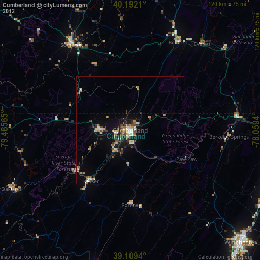
» Earth at Night: Flat Maps 2012, 2016