Country Club Estates night lights from space
Night Light of Country Club Estates (Georgia) from space (United States) Src. Average luminocity for 10x10km area is 62.0437% and for 50x50km: 18.5048%.
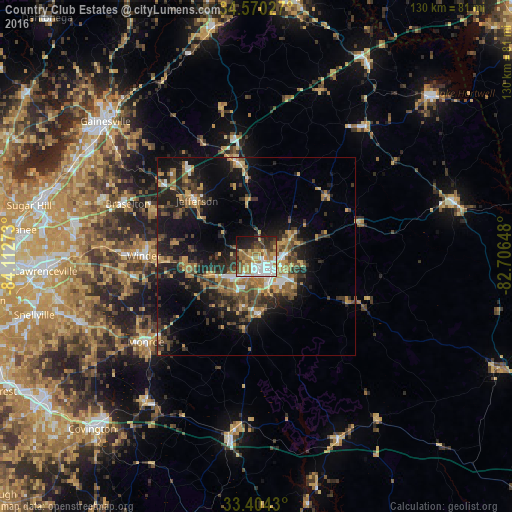
Analysis of Country Club Estates night lights 2016
Square area 10x10 km:
 14.69%
90-99
11.89%80-89
7.17%70-79
10.66%60-69
9.79%50-59
9.27%40-49
8.22%30-39
7.87%20-29
9.44%10-19
9.79%0-9
1.22%Square area 50x50 km:
1.52%90-99
1.54%80-89
1.89%70-79
3.3%60-69
2.98%50-59
3.56%40-49
3.24%30-39
4.73%20-29
5.65%10-19
13.82%0-9
57.78%Clear (daylight) street map image can be seen on geolist.org.
Map coordinates:
34° 34' 13" North, 84° 6' 45.8" West
33° 59' 21.4" North, 83° 24' 34.6" West
33° 24' 15.5" North, 82° 42' 23.3" West
Some cities around Country Club Estates sort by population:
• Athens
4.3 km =2.7 mi,  137°
137°
• Winder
28.6 km =17.8 mi,  270°
270°
• Monroe
35.4 km =22 mi,  232°
232°
• Jefferson
20.7 km =12.9 mi,  313°
313°
• Braselton
35.2 km =21.9 mi,  292°
292°
• Auburn
38.6 km =24 mi, 274°
• Commerce
24.3 km =15.1 mi,  349°
349°
• Dacula
45 km =28 mi, 269°
4189612 (p: 7,555)
Sources (retrieved 2019-11-25):
» Earth at Night: Flat Maps 2012, 2016