Braselton night lights from space
Night Light of Braselton (Georgia) from space (United States) Src. Average luminocity for 10x10km area is 42.13% and for 50x50km: 43.4488%.
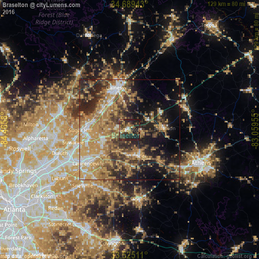
Analysis of Braselton night lights 2016
Square area 10x10 km:
 3.66%
3.66%90-99
2.75%80-89
4.76%70-79
6.04%60-69
7.69%50-59
6.23%40-49
12.82%30-39
10.99%20-29
29.3%10-19
15.75%0-9
0%Square area 50x50 km:
4.21%90-99
4.69%80-89
6.25%70-79
11.44%60-69
9.63%50-59
6.59%40-49
6.82%30-39
8.09%20-29
11.18%10-19
13.68%0-9
17.42%Clear (daylight) street map image can be seen on geolist.org.
Map coordinates:
34° 41' 21.9" North, 84° 27' 56.9" West
34° 6' 33.4" North, 83° 45' 45.6" West
33° 31' 30.4" North, 83° 3' 34.4" West
Some cities around Braselton sort by population:
• Gainesville
21.7 km =13.5 mi,  344°
344°
• Sugar Hill
24.9 km =15.5 mi,  269°
269°
• Winder
13.5 km =8.4 mi,  163°
163°
• Buford
22.3 km =13.9 mi, 273°
• Jefferson
17.5 km =10.9 mi,  87°
87°
• Auburn
12.2 km =7.6 mi,  209°
209°
• Flowery Branch
17.2 km =10.7 mi,  299°
299°
• Dacula
18.3 km =11.4 mi,  222°
222°
4184165 (p: 9,476)
Sources (retrieved 2019-11-25):
» Earth at Night: Flat Maps 2012, 2016