Corona night lights from space
Night Light of Corona (California) from space (United States) Src. Average luminocity for 10x10km area is 79.9266% and for 50x50km: 61.0976%.
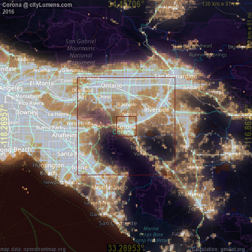
Analysis of Corona night lights 2016
Square area 10x10 km:
 19.76%
90-99
21.85%80-89
7.69%70-79
18.88%60-69
20.1%50-59
5.42%40-49
3.32%30-39
1.22%20-29
1.4%10-19
0.35%0-9
0%Square area 50x50 km:
14.81%90-99
13.94%80-89
6.67%70-79
9.89%60-69
14.12%50-59
7.34%40-49
6.03%30-39
4.02%20-29
4.07%10-19
8.32%0-9
10.78%Clear (daylight) street map image can be seen on geolist.org.
Map coordinates:
34° 27' 25.4" North, 118° 16' 10.5" West
33° 52' 31" North, 117° 33' 59.2" West
33° 17' 22.3" North, 116° 51' 48" West
Some cities around Corona sort by population:
• Eastvale
9.8 km =6.1 mi,  1°
1°
• Norco
6.4 km =4 mi,  14°
14°
• Jurupa Valley
13.8 km =8.6 mi,  19°
19°
• Glen Avon
16.9 km =10.5 mi,  26°
26°
• Pedley
13.9 km =8.6 mi,  36°
36°
• Home Gardens
4.2 km =2.6 mi,  85°
85°
• Los Serranos
17 km =10.6 mi,  309°
309°
• El Cerrito Corona
5.6 km =3.5 mi,  133°
133°
5339631 (p: 164,226)
Sources (retrieved 2019-11-25):
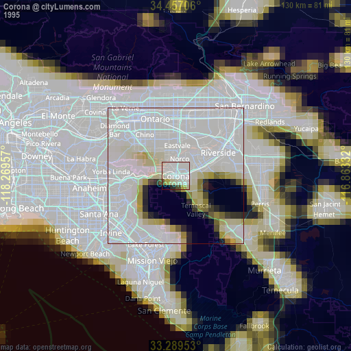
» NASA, Earths city lights 1995
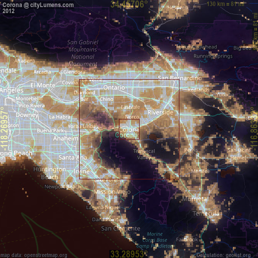
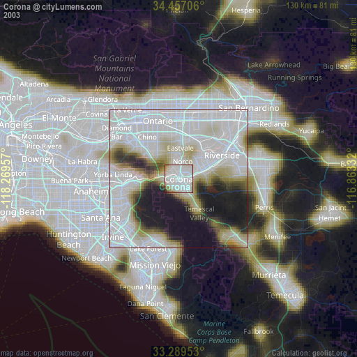
» NASA city lights 2003
» Earth at Night: Flat Maps 2012, 2016