Eastvale night lights from space
Night Light of Eastvale (California) from space (United States) Src. Average luminocity for 10x10km area is 76.6871% and for 50x50km: 65.464%.
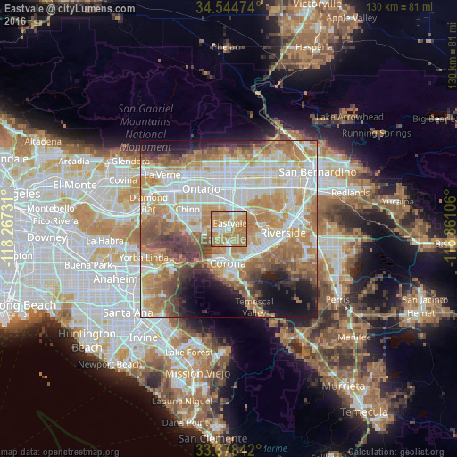
Analysis of Eastvale night lights 2016
Square area 10x10 km:
 5.77%
5.77%90-99
19.76%80-89
8.92%70-79
24.3%60-69
39.69%50-59
1.4%40-49
0.17%30-39
0%20-29
0%10-19
0%0-9
0%Square area 50x50 km:
15.48%90-99
15.17%80-89
7.82%70-79
11.09%60-69
15.39%50-59
7.61%40-49
5.85%30-39
3.95%20-29
4.15%10-19
7.49%0-9
6%Clear (daylight) street map image can be seen on geolist.org.
Map coordinates:
34° 32' 41.1" North, 118° 16' 2.3" West
33° 57' 48.9" North, 117° 33' 51" West
33° 22' 42.3" North, 116° 51' 39.8" West
Some cities around Eastvale sort by population:
• Corona
9.8 km =6.1 mi,  181°
181°
• Chino
12.7 km =7.9 mi,  295°
295°
• Norco
3.9 km =2.4 mi,  158°
158°
• Jurupa Valley
5.5 km =3.4 mi,  53°
53°
• Glen Avon
9.1 km =5.7 mi, 53°
• Pedley
8.2 km =5.1 mi,  80°
80°
• Home Gardens
10.3 km =6.4 mi, 157°
• Sunnyslope
13.2 km =8.2 mi,  65°
65°
8096217 (p: 59,039)
Sources (retrieved 2019-11-25):
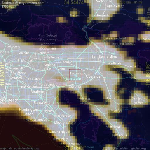
» NASA, Earths city lights 1995
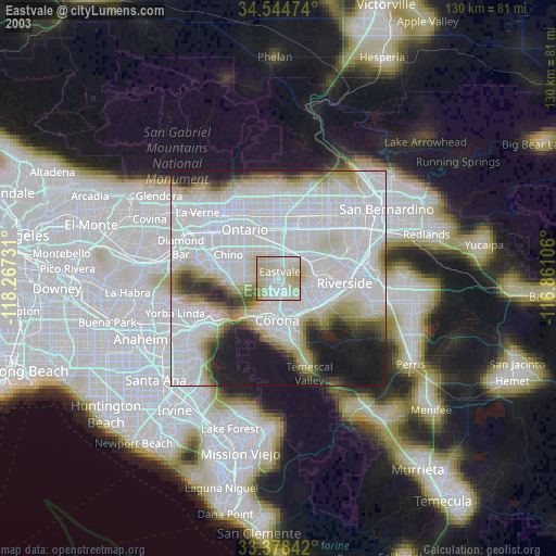
» NASA city lights 2003
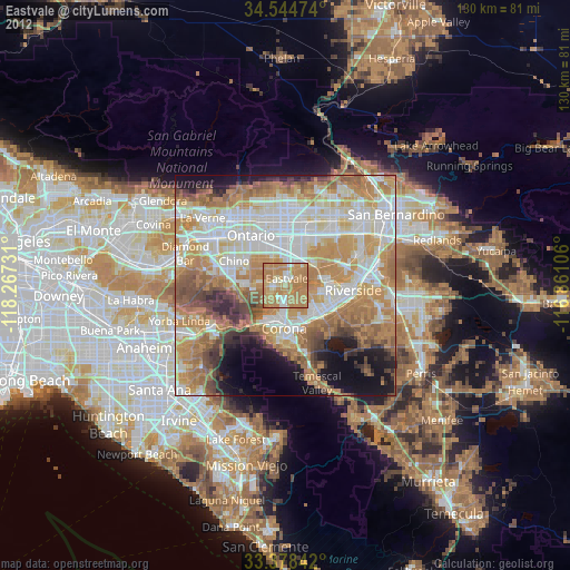
» Earth at Night: Flat Maps 2012, 2016