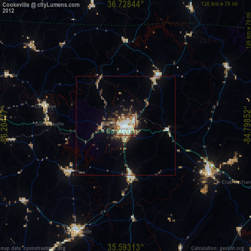
Cookeville night lights from space
Night Light of Cookeville (Tennessee) from space (United States) Src. Average luminocity for 10x10km area is 80.507% and for 50x50km: 9.8373%.

Analysis of Cookeville night lights 2016
Square area 10x10 km:
 18.53%
90-99
24.3%80-89
16.78%70-79
11.19%60-69
11.19%50-59
10.49%40-49
3.85%30-39
2.1%20-29
1.57%10-19
0%0-9
0%Square area 50x50 km:
0.84%90-99
1.14%80-89
1.44%70-79
1.44%60-69
1.22%50-59
1.62%40-49
1.26%30-39
3.02%20-29
2.65%10-19
5.53%0-9
79.84%Clear (daylight) street map image can be seen on geolist.org.
Map coordinates:
36° 43' 42.4" North, 86° 12' 17.2" West
36° 9' 46.2" North, 85° 30' 5.9" West
35° 35' 35.3" North, 84° 47' 54.7" West
Some cities around Cookeville sort by population:
• Murfreesboro
87.4 km =54.3 mi,  246°
246°
• Lebanon
71 km =44.1 mi,  274°
274°
• McMinnville
58.5 km =36.4 mi,  204°
204°
• Crossville
48.9 km =30.4 mi,  119°
119°
• Dayton
86.5 km =53.7 mi,  149°
149°
• Fairfield Glade
58.2 km =36.2 mi,  108°
108°
• Rockwood
80.5 km =50 mi, 114°
• Sparta
26.6 km =16.5 mi,  172°
172°
4615145 (p: 32,113)
Sources (retrieved 2019-11-25):
» Earth at Night: Flat Maps 2012, 2016