Columbus night lights from space
Night Light of Columbus (Georgia) from space (United States) Src. Average luminocity for 10x10km area is 91.5549% and for 50x50km: 25.1783%.
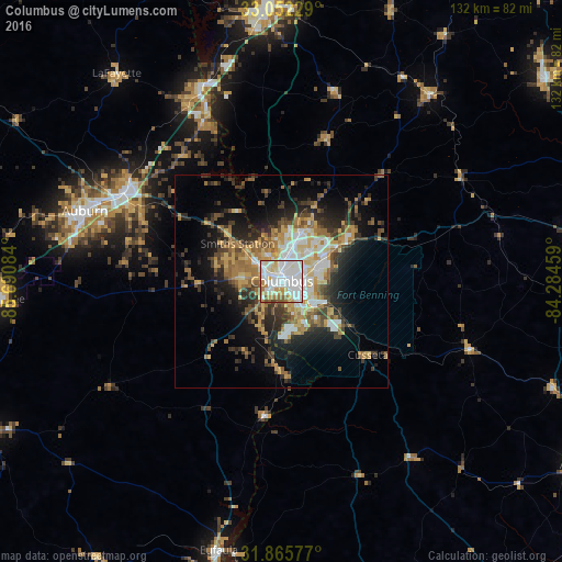
Analysis of Columbus night lights 2016
Square area 10x10 km:
 40.48%
90-99
32.6%80-89
8.97%70-79
7.51%60-69
6.23%50-59
3.11%40-49
1.1%30-39
0%20-29
0%10-19
0%0-9
0%Square area 50x50 km:
4.15%90-99
3.96%80-89
3.47%70-79
3.72%60-69
4.11%50-59
3%40-49
3.26%30-39
4.8%20-29
5.96%10-19
10.39%0-9
53.18%Clear (daylight) street map image can be seen on geolist.org.
Map coordinates:
33° 3' 8.2" North, 85° 41' 27" West
32° 27' 39.5" North, 84° 59' 15.8" West
31° 51' 56.8" North, 84° 17' 4.5" West
Some cities around Columbus sort by population:
• Auburn
49.1 km =30.5 mi,  289°
289°
• Phenix City
1.7 km =1.1 mi,  312°
312°
• LaGrange
64.4 km =40 mi,  356°
356°
• Opelika
42 km =26.1 mi,  299°
299°
• Cusseta
26.6 km =16.5 mi,  130°
130°
• Valley
43.6 km =27.1 mi,  335°
335°
• Lanett
49.2 km =30.6 mi, 337°
• Smiths Station
13.6 km =8.5 mi, 310°
4188985 (p: 200,579)
Sources (retrieved 2019-11-25):
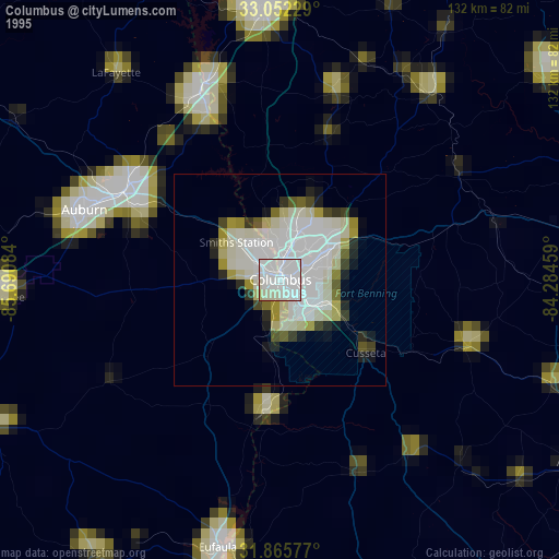
» NASA, Earths city lights 1995
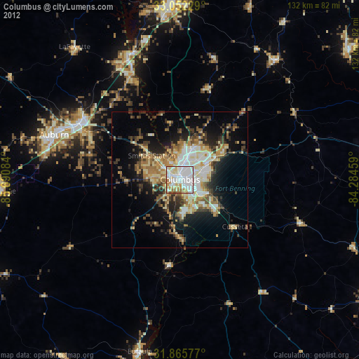
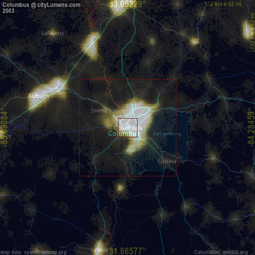
» NASA city lights 2003
» Earth at Night: Flat Maps 2012, 2016