Cloverdale night lights from space
Night Light of Cloverdale (California) from space (United States) Src. Average luminocity for 10x10km area is 6.3452% and for 50x50km: 1.0852%.
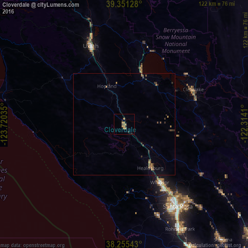
Analysis of Cloverdale night lights 2016
Square area 10x10 km:
 0%
0%90-99
0%80-89
0%70-79
4.93%60-69
0.51%50-59
1.19%40-49
0.17%30-39
1.02%20-29
1.02%10-19
0.34%0-9
90.82%Square area 50x50 km:
0%90-99
0%80-89
0.01%70-79
0.4%60-69
0.18%50-59
0.22%40-49
0.27%30-39
0.44%20-29
0.17%10-19
0.1%0-9
98.21%Clear (daylight) street map image can be seen on geolist.org.
Map coordinates:
39° 21' 4.6" North, 123° 43' 13.3" West
38° 48' 19.7" North, 123° 1' 2" West
38° 15' 19.5" North, 122° 18' 50.8" West
Some cities around Cloverdale sort by population:
• Windsor
33.6 km =20.9 mi,  148°
148°
• Ukiah
41.7 km =25.9 mi,  336°
336°
• Clearlake
37.9 km =23.5 mi,  63°
63°
• Healdsburg
25.2 km =15.7 mi, 149°
• Larkfield-Wikiup
39.9 km =24.8 mi,  144°
144°
• Sebastopol
47.9 km =29.8 mi,  159°
159°
• Hidden Valley Lake
39.8 km =24.7 mi,  89°
89°
• Calistoga
45.6 km =28.3 mi,  123°
123°
5338104 (p: 8,811)
Sources (retrieved 2019-11-25):
» Earth at Night: Flat Maps 2012, 2016