Clairton night lights from space
Night Light of Clairton (Pennsylvania) from space (United States) Src. Average luminocity for 10x10km area is 56.9592% and for 50x50km: 46.4989%.
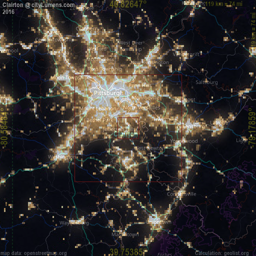
Analysis of Clairton night lights 2016
Square area 10x10 km:
 3.74%
3.74%90-99
8.33%80-89
7.14%70-79
8.33%60-69
16.16%50-59
17.52%40-49
13.78%30-39
13.1%20-29
8.84%10-19
3.06%0-9
0%Square area 50x50 km:
7.41%90-99
8.67%80-89
5.73%70-79
6.84%60-69
9.51%50-59
8.66%40-49
6.62%30-39
6.33%20-29
9.73%10-19
12.16%0-9
18.32%Clear (daylight) street map image can be seen on geolist.org.
Map coordinates:
40° 49' 35.3" North, 80° 35' 5.4" West
40° 17' 32.2" North, 79° 52' 54.2" West
39° 45' 13.9" North, 79° 10' 42.9" West
Some cities around Clairton sort by population:
• West Mifflin
8 km =5 mi,  9°
9°
• Baldwin
9.7 km =6 mi,  301°
301°
• McKeesport
6.4 km =4 mi, 13°
• South Park Township
9.6 km =6 mi,  274°
274°
• Jefferson Hills
4.3 km =2.7 mi, 268°
• Pleasant Hills
8.2 km =5.1 mi,  305°
305°
• White Oak
7.9 km =4.9 mi,  50°
50°
• Wilson
2.1 km =1.3 mi,  337°
337°
5184396 (p: 6,681)
Sources (retrieved 2019-11-25):
» Earth at Night: Flat Maps 2012, 2016