Ceres night lights from space
Night Light of Ceres (California) from space (United States) Src. Average luminocity for 10x10km area is 68.5374% and for 50x50km: 23.7435%.
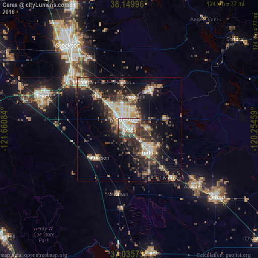
Analysis of Ceres night lights 2016
Square area 10x10 km:
 17.86%
90-99
18.2%80-89
8.5%70-79
4.93%60-69
8.16%50-59
11.39%40-49
11.05%30-39
9.86%20-29
8.67%10-19
1.36%0-9
0%Square area 50x50 km:
2.94%90-99
3.64%80-89
1.88%70-79
3.79%60-69
3.06%50-59
3.39%40-49
4.65%30-39
5.84%20-29
6.95%10-19
15.17%0-9
48.69%Clear (daylight) street map image can be seen on geolist.org.
Map coordinates:
38° 8' 59.9" North, 121° 39' 39" West
37° 35' 41.7" North, 120° 57' 27.8" West
37° 2' 8.6" North, 120° 15' 16.5" West
Some cities around Ceres sort by population:
• Modesto
6 km =3.7 mi,  324°
324°
• Turlock
14.8 km =9.2 mi,  138°
138°
• Riverbank
15.8 km =9.8 mi,  7°
7°
• Salida
16.7 km =10.4 mi, 317°
• Hughson
8.1 km =5 mi,  88°
88°
• West Modesto
7.6 km =4.7 mi,  289°
289°
• Keyes
5.7 km =3.5 mi, 138°
• Bret Harte
4.3 km =2.7 mi,  280°
280°
5335650 (p: 47,963)
Sources (retrieved 2019-11-25):
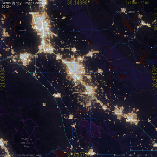
» Earth at Night: Flat Maps 2012, 2016