Central night lights from space
Night Light of Central (Louisiana) from space (United States) Src. Average luminocity for 10x10km area is 65.174% and for 50x50km: 45.8927%.
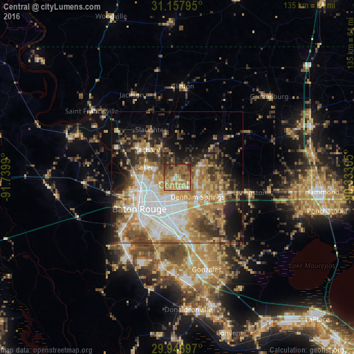
Analysis of Central night lights 2016
Square area 10x10 km:
 2.2%
2.2%90-99
6.23%80-89
9.34%70-79
20.88%60-69
28.94%50-59
15.2%40-49
9.16%30-39
5.49%20-29
2.56%10-19
0%0-9
0%Square area 50x50 km:
9.72%90-99
7.21%80-89
6.89%70-79
7.82%60-69
8.99%50-59
5.68%40-49
5.9%30-39
6.11%20-29
7.16%10-19
10.1%0-9
24.43%Clear (daylight) street map image can be seen on geolist.org.
Map coordinates:
31° 9' 28.6" North, 91° 44' 23.6" West
30° 33' 15.7" North, 91° 2' 12.4" West
29° 56' 49.1" North, 90° 20' 1.1" West
Some cities around Central sort by population:
• Shenandoah
17.4 km =10.8 mi,  168°
168°
• Zachary
15.5 km =9.6 mi,  312°
312°
• Baker
13.1 km =8.1 mi,  286°
286°
• Denham Springs
10.6 km =6.6 mi,  134°
134°
• Merrydale
9.1 km =5.7 mi,  229°
229°
• Inniswold
17.2 km =10.7 mi,  195°
195°
• Brownsfield
8.1 km =5 mi,  263°
263°
• Monticello
7.3 km =4.5 mi,  188°
188°
4319435 (p: 28,295)
Sources (retrieved 2019-11-25):
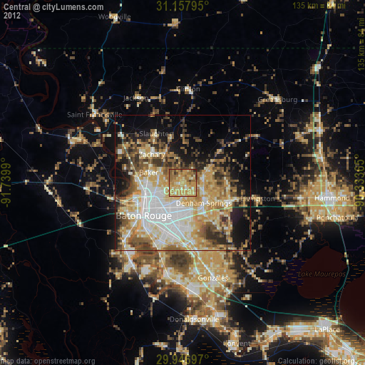
» Earth at Night: Flat Maps 2012, 2016