Center City night lights from space
Night Light of Center City (Pennsylvania) from space (United States) Src. Average luminocity for 10x10km area is 99.6293% and for 50x50km: 81.5007%.
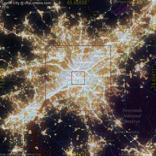

Analysis of Center City night lights 2016
Square area 10x10 km:
 89.63%
90-99
8.84%80-89
1.53%70-79
0%60-69
0%50-59
0%40-49
0%30-39
0%20-29
0%10-19
0%0-9
0%Square area 50x50 km:
26.23%90-99
19.53%80-89
11.89%70-79
15.25%60-69
13.22%50-59
6.17%40-49
4.25%30-39
2.27%20-29
1.16%10-19
0.03%0-9
0%Clear (daylight) street map image can be seen on geolist.org.
Map coordinates:
40° 29' 17.1" North, 75° 51' 44.5" West
39° 57' 4.3" North, 75° 9' 33.2" West
39° 24' 36.3" North, 74° 27' 22" West
Some cities around Center City sort by population:
• Philadelphia
0.4 km =0.2 mi,  287°
287°
• Camden
4.4 km =2.7 mi,  129°
129°
• Whitman
3.8 km =2.4 mi,  175°
175°
• Wharton
2.7 km =1.7 mi, 176°
• Pennsport
2.7 km =1.7 mi,  164°
164°
• Collingswood
8.3 km =5.2 mi,  116°
116°
• Yeadon
8.3 km =5.2 mi,  260°
260°
• Gloucester City
7.6 km =4.7 mi,  151°
151°
9958118 (p: 57,239)
Sources (retrieved 2019-11-25):
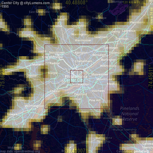
» NASA, Earths city lights 1995
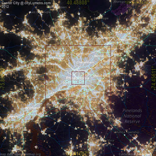
» NASA city lights 2003
» Earth at Night: Flat Maps 2012, 2016