Catalina Foothills night lights from space
Night Light of Catalina Foothills (Arizona) from space (United States) Src. Average luminocity for 10x10km area is 71.1502% and for 50x50km: 32.6676%.
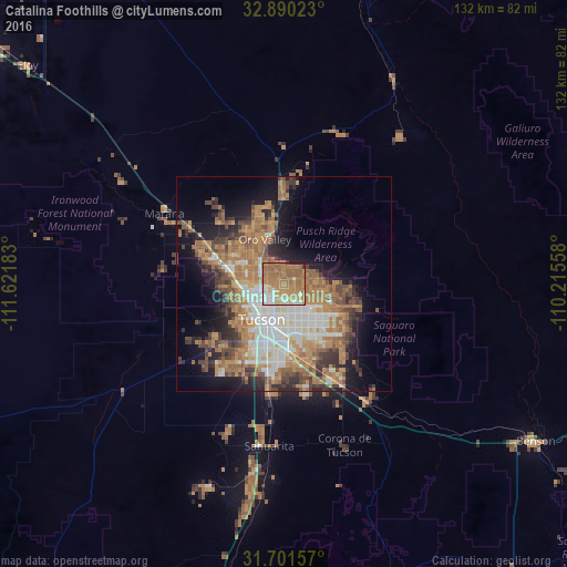
Analysis of Catalina Foothills night lights 2016
Square area 10x10 km:
 7.51%
7.51%90-99
11.54%80-89
6.04%70-79
15.2%60-69
41.76%50-59
15.02%40-49
0%30-39
0.92%20-29
1.65%10-19
0.37%0-9
0%Square area 50x50 km:
5.41%90-99
5.21%80-89
1.88%70-79
5.72%60-69
10.09%50-59
5.64%40-49
4.45%30-39
4.15%20-29
5.1%10-19
9.92%0-9
42.43%Clear (daylight) street map image can be seen on geolist.org.
Map coordinates:
32° 53' 24.8" North, 111° 37' 18.6" West
32° 17' 52.3" North, 110° 55' 7.3" West
31° 42' 5.7" North, 110° 12' 56.1" West
Some cities around Catalina Foothills sort by population:
• Tucson
8.5 km =5.3 mi,  184°
184°
• Casas Adobes
7.7 km =4.8 mi,  291°
291°
• Oro Valley
11.3 km =7 mi,  336°
336°
• Drexel Heights
20.2 km =12.6 mi,  210°
210°
• Tanque Verde
17.8 km =11.1 mi,  106°
106°
• Flowing Wells
8.6 km =5.3 mi,  267°
267°
• Tucson Estates
20.3 km =12.6 mi,  232°
232°
• South Tucson
11.9 km =7.4 mi,  203°
203°
5288786 (p: 50,796)
Sources (retrieved 2019-11-25):
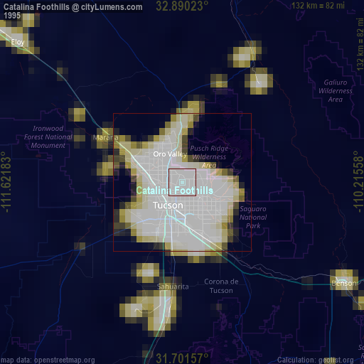
» NASA, Earths city lights 1995
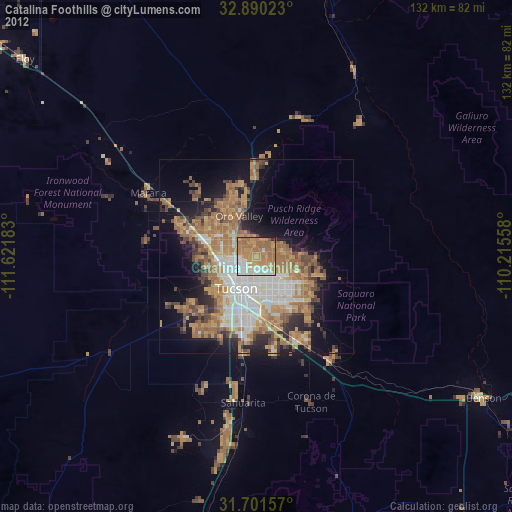
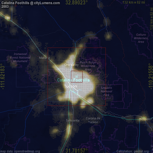
» NASA city lights 2003
» Earth at Night: Flat Maps 2012, 2016