Cape Coral night lights from space
Night Light of Cape Coral (Florida) from space (United States) Src. Average luminocity for 10x10km area is 76.3409% and for 50x50km: 37.0895%.
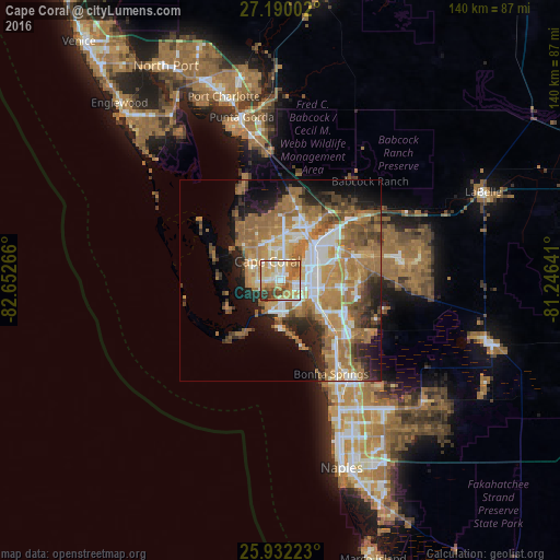

Analysis of Cape Coral night lights 2016
Square area 10x10 km:
 11.74%
90-99
19.13%80-89
14.77%70-79
20.45%60-69
16.29%50-59
8.14%40-49
3.98%30-39
4.92%20-29
0.57%10-19
0%0-9
0%Square area 50x50 km:
4.98%90-99
6.09%80-89
3.42%70-79
6.52%60-69
13.25%50-59
6.32%40-49
4.22%30-39
3.36%20-29
6.3%10-19
8.7%0-9
36.83%Clear (daylight) street map image can be seen on geolist.org.
Map coordinates:
27° 11' 24.1" North, 82° 39' 9.6" West
26° 33' 46.3" North, 81° 56' 58.3" West
25° 55' 56" North, 81° 14' 47.1" West
Some cities around Cape Coral sort by population:
• Fort Myers
12.7 km =7.9 mi,  58°
58°
• North Fort Myers
13.5 km =8.4 mi,  30°
30°
• Iona
4.9 km =3 mi,  196°
196°
• Cypress Lake
5.7 km =3.5 mi,  118°
118°
• Villas
8.2 km =5.1 mi,  99°
99°
• McGregor
3.5 km =2.2 mi,  93°
93°
• Sanibel
14.6 km =9.1 mi,  209°
209°
• Fort Myers Beach
12.2 km =7.6 mi,  180°
180°
4149962 (p: 175,229)
Sources (retrieved 2019-11-25):
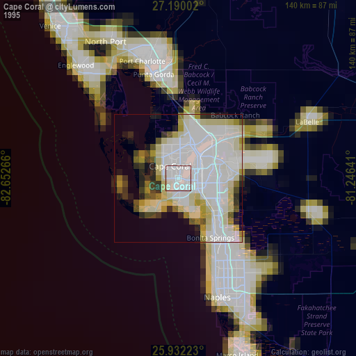
» NASA, Earths city lights 1995
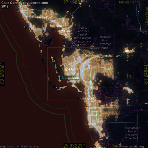
» NASA city lights 2003
» Earth at Night: Flat Maps 2012, 2016