Camden night lights from space
Night Light of Camden (South Carolina) from space (United States) Src. Average luminocity for 10x10km area is 50.0092% and for 50x50km: 12.4147%.
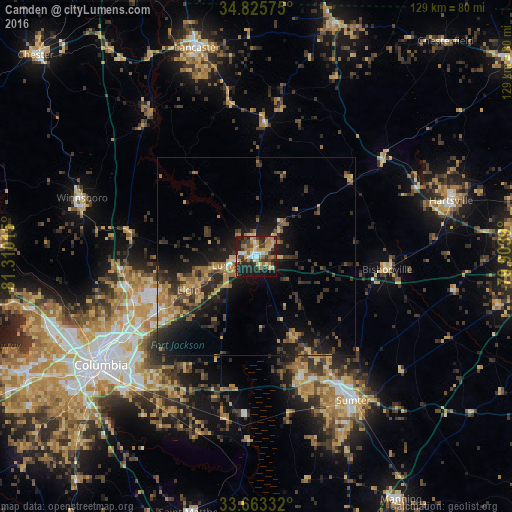
Analysis of Camden night lights 2016
Square area 10x10 km:
 5.86%
5.86%90-99
6.04%80-89
9.52%70-79
9.71%60-69
10.07%50-59
3.3%40-49
6.96%30-39
13%20-29
20.7%10-19
14.84%0-9
0%Square area 50x50 km:
0.38%90-99
0.58%80-89
1.77%70-79
2.21%60-69
2.6%50-59
1.42%40-49
2.21%30-39
3.81%20-29
4.8%10-19
9.85%0-9
70.37%Clear (daylight) street map image can be seen on geolist.org.
Map coordinates:
34° 49' 32.7" North, 81° 18' 36.5" West
34° 14' 47.5" North, 80° 36' 25.3" West
33° 39' 48" North, 79° 54' 14" West
Some cities around Camden sort by population:
• Columbia
47.9 km =29.8 mi,  235°
235°
• Sumter
43.7 km =27.2 mi,  146°
146°
• West Columbia
51.4 km =31.9 mi, 236°
• Dentsville
38.2 km =23.7 mi, 237°
• Forest Acres
43.4 km =27 mi,  234°
234°
• Woodfield
36.4 km =22.6 mi, 235°
• Hartsville
51 km =31.7 mi,  73°
73°
• Lugoff
7.9 km =4.9 mi,  254°
254°
4573209 (p: 7,085)
Sources (retrieved 2019-11-25):
» Earth at Night: Flat Maps 2012, 2016