California night lights from space
Night Light of California (Pennsylvania) from space (United States) Src. Average luminocity for 10x10km area is 29.0698% and for 50x50km: 20.7135%.
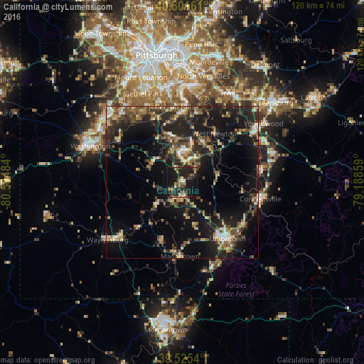
Analysis of California night lights 2016
Square area 10x10 km:
 0.81%
0.81%90-99
2.44%80-89
1.79%70-79
2.92%60-69
6.66%50-59
6.17%40-49
3.57%30-39
6.17%20-29
15.1%10-19
48.05%0-9
6.33%Square area 50x50 km:
1.28%90-99
2.08%80-89
2.16%70-79
2.15%60-69
3.02%50-59
3.73%40-49
4.31%30-39
4.72%20-29
9.06%10-19
19.16%0-9
48.32%Clear (daylight) street map image can be seen on geolist.org.
Map coordinates:
40° 36' 5.8" North, 80° 35' 41.4" West
40° 3' 56.3" North, 79° 53' 30.2" West
39° 31' 31.4" North, 79° 11' 18.9" West
Some cities around California sort by population:
• South Park Township
27.3 km =17 mi,  341°
341°
• Jefferson Hills
25.3 km =15.7 mi,  352°
352°
• Uniontown
23.7 km =14.7 mi,  140°
140°
• Maple Glen
9.1 km =5.7 mi,  232°
232°
• Wilson
27.2 km =16.9 mi,  0°
0°
• Connellsville
26.3 km =16.3 mi,  101°
101°
• Monessen
9.2 km =5.7 mi, 2°
• Clairton
25.2 km =15.7 mi, 1°
5182733 (p: 6,608)
Sources (retrieved 2019-11-25):
» Earth at Night: Flat Maps 2012, 2016