North Little Rock night lights from space
Night Light of North Little Rock (Arkansas) from space (United States) Src. Average luminocity for 10x10km area is 93.4029% and for 50x50km: 39.4967%.
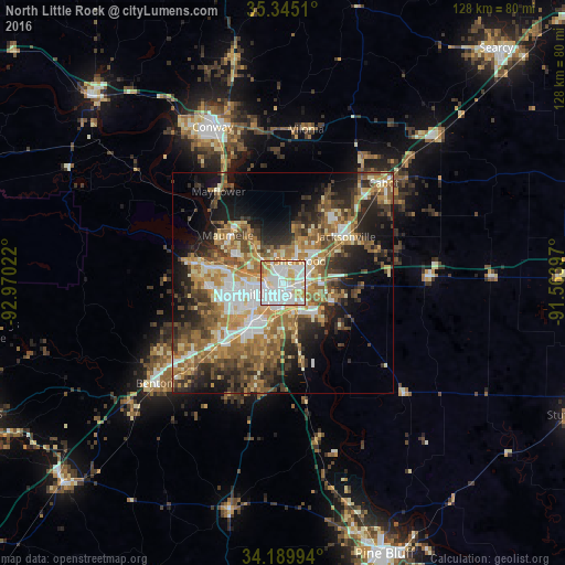
Analysis of North Little Rock night lights 2016
Square area 10x10 km:
 40.48%
90-99
33.52%80-89
10.99%70-79
12.09%60-69
2.93%50-59
0%40-49
0%30-39
0%20-29
0%10-19
0%0-9
0%Square area 50x50 km:
5.98%90-99
7.35%80-89
4.72%70-79
6.63%60-69
6.94%50-59
7.25%40-49
5.46%30-39
6.58%20-29
8.39%10-19
11.97%0-9
28.73%Clear (daylight) street map image can be seen on geolist.org.
Map coordinates:
35° 20' 42.4" North, 92° 58' 12.8" West
34° 46' 10.3" North, 92° 16' 1.5" West
34° 11' 23.8" North, 91° 33' 50.3" West
Some cities around North Little Rock sort by population:
• Little Rock
3.3 km =2.1 mi,  218°
218°
• Benton
37.1 km =23.1 mi,  232°
232°
• Sherwood
6.4 km =4 mi,  37°
37°
• Jacksonville
17.9 km =11.1 mi,  53°
53°
• Cabot
32.3 km =20.1 mi, 45°
• Bryant
28 km =17.4 mi, 226°
• Maumelle
16.5 km =10.3 mi,  310°
310°
• East End
25.3 km =15.7 mi,  195°
195°
4124112 (p: 66,504)
Sources (retrieved 2019-11-25):
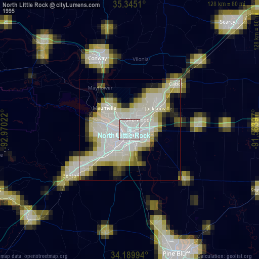
» NASA, Earths city lights 1995
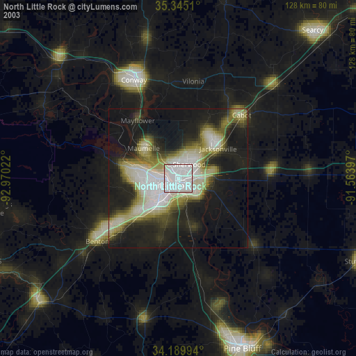
» NASA city lights 2003
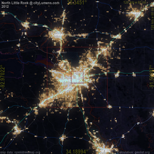
» Earth at Night: Flat Maps 2012, 2016