Palos Hills night lights from space
Night Light of Palos Hills (Illinois) from space (United States) Src. Average luminocity for 10x10km area is 86.8377% and for 50x50km: 86.1546%.
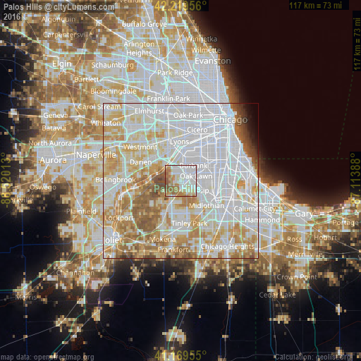
Analysis of Palos Hills night lights 2016
Square area 10x10 km:
 35.71%
90-99
23.54%80-89
10.39%70-79
6.66%60-69
16.88%50-59
6.17%40-49
0.65%30-39
0%20-29
0%10-19
0%0-9
0%Square area 50x50 km:
38.9%90-99
21.04%80-89
10.86%70-79
10.29%60-69
8.58%50-59
5.39%40-49
1.84%30-39
0.95%20-29
0.53%10-19
0.68%0-9
0.93%Clear (daylight) street map image can be seen on geolist.org.
Map coordinates:
42° 13' 10.4" North, 88° 31' 12.5" West
41° 41' 48.1" North, 87° 49' 1.2" West
41° 10' 10.4" North, 87° 6' 50" West
Some cities around Palos Hills sort by population:
• Oak Lawn
5.1 km =3.2 mi,  72°
72°
• Burbank
5.2 km =3.2 mi,  36°
36°
• Bridgeview
6 km =3.7 mi,  10°
10°
• Chicago Ridge
3.2 km =2 mi,  80°
80°
• Hickory Hills
3.3 km =2.1 mi,  348°
348°
• Justice
5.6 km =3.5 mi,  341°
341°
• Worth
1.8 km =1.1 mi,  115°
115°
• Willow Springs
6.1 km =3.8 mi,  323°
323°
4905263 (p: 17,565)
Sources (retrieved 2019-11-25):
» Earth at Night: Flat Maps 2012, 2016