Bowling Green night lights from space
Night Light of Bowling Green (Kentucky) from space (United States) Src. Average luminocity for 10x10km area is 73.8344% and for 50x50km: 8.5418%.
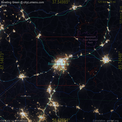
Analysis of Bowling Green night lights 2016
Square area 10x10 km:
 22.4%
22.4%90-99
26.14%80-89
6.17%70-79
7.63%60-69
4.55%50-59
7.79%40-49
7.14%30-39
4.71%20-29
10.23%10-19
3.25%0-9
0%Square area 50x50 km:
1.28%90-99
1.55%80-89
1.03%70-79
0.96%60-69
0.93%50-59
1.57%40-49
1.07%30-39
1.25%20-29
2.22%10-19
4.33%0-9
83.82%Clear (daylight) street map image can be seen on geolist.org.
Map coordinates:
37° 32' 59.5" North, 87° 8' 48.2" West
36° 59' 25.2" North, 86° 26' 37" West
36° 25' 35.9" North, 85° 44' 25.7" West
Some cities around Bowling Green sort by population:
• Springfield
66.4 km =41.3 mi,  216°
216°
• Glasgow
47.2 km =29.3 mi,  89°
89°
• Portland
45.9 km =28.5 mi,  188°
188°
• White House
60.7 km =37.7 mi,  197°
197°
• Franklin
32.1 km =19.9 mi, 201°
• Oak Grove
48 km =29.8 mi,  324°
324°
• Russellville
42.6 km =26.5 mi,  247°
247°
• Leitchfield
56 km =34.8 mi,  13°
13°
4285268 (p: 63,616)
Sources (retrieved 2019-11-25):
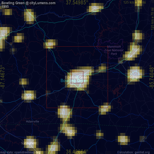
» NASA, Earths city lights 1995
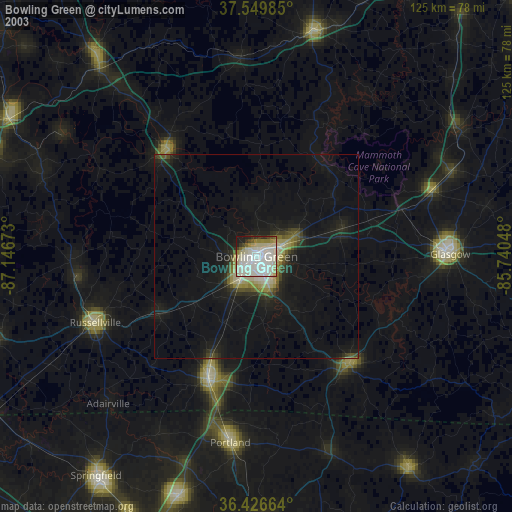
» NASA city lights 2003
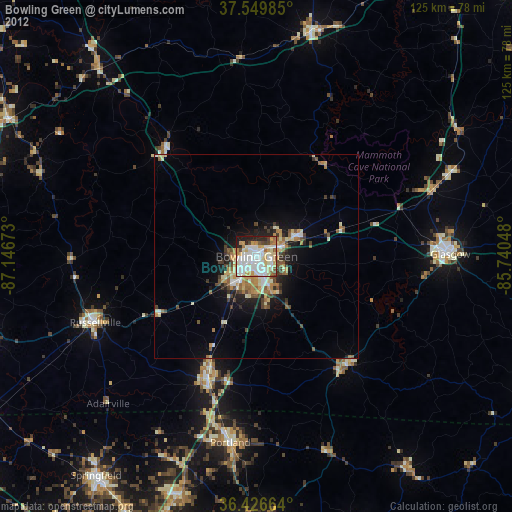
» Earth at Night: Flat Maps 2012, 2016