Portland night lights from space
Night Light of Portland (Tennessee) from space (United States) Src. Average luminocity for 10x10km area is 44.4286% and for 50x50km: 13.8306%.
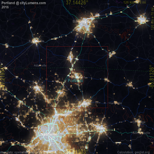
Analysis of Portland night lights 2016
Square area 10x10 km:
 3.85%
3.85%90-99
5.31%80-89
8.79%70-79
3.66%60-69
9.52%50-59
11.54%40-49
5.31%30-39
9.89%20-29
15.2%10-19
25.09%0-9
1.83%Square area 50x50 km:
0.91%90-99
1.08%80-89
2.21%70-79
1.46%60-69
1.96%50-59
2.5%40-49
2.43%30-39
3.97%20-29
5.22%10-19
11.85%0-9
66.4%Clear (daylight) street map image can be seen on geolist.org.
Map coordinates:
37° 8' 39.3" North, 87° 13' 10.2" West
36° 34' 54.2" North, 86° 30' 59" West
36° 0' 54.1" North, 85° 48' 47.7" West
Some cities around Portland sort by population:
• Hendersonville
32.2 km =20 mi,  196°
196°
• Gallatin
22.4 km =13.9 mi,  163°
163°
• Goodlettsville
33.7 km =20.9 mi,  211°
211°
• Springfield
33.9 km =21.1 mi,  256°
256°
• White House
17.3 km =10.7 mi,  224°
224°
• Franklin
16.5 km =10.3 mi,  340°
340°
• Greenbrier
31 km =19.3 mi,  236°
236°
• Millersville
29.1 km =18.1 mi, 216°
4650946 (p: 12,323)
Sources (retrieved 2019-11-25):
» Earth at Night: Flat Maps 2012, 2016