Bellevue night lights from space
Night Light of Bellevue (Ohio) from space (United States) Src. Average luminocity for 10x10km area is 22.3896% and for 50x50km: 10.581%.
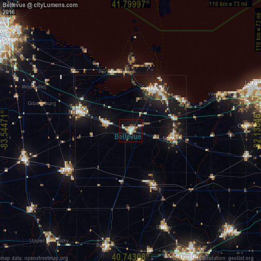
Analysis of Bellevue night lights 2016
Square area 10x10 km:
 3.08%
3.08%90-99
5.03%80-89
1.79%70-79
1.79%60-69
2.76%50-59
3.41%40-49
2.6%30-39
2.11%20-29
1.62%10-19
24.68%0-9
51.14%Square area 50x50 km:
1.18%90-99
1.76%80-89
1.18%70-79
0.89%60-69
1.02%50-59
1.58%40-49
1.43%30-39
1.34%20-29
2.34%10-19
11.07%0-9
76.22%Clear (daylight) street map image can be seen on geolist.org.
Map coordinates:
41° 47' 59.9" North, 83° 32' 41" West
41° 16' 25.2" North, 82° 50' 29.7" West
40° 44' 35.1" North, 82° 8' 18.5" West
Some cities around Bellevue sort by population:
• Sandusky
22.5 km =14 mi,  29°
29°
• Tiffin
33.2 km =20.6 mi,  237°
237°
• Norwalk
19.2 km =11.9 mi,  100°
100°
• Fremont
24.9 km =15.5 mi,  290°
290°
• Huron
27.5 km =17.1 mi,  60°
60°
• Clyde
11.7 km =7.3 mi, 286°
• Willard
26.4 km =16.4 mi,  158°
158°
• Port Clinton
27.7 km =17.2 mi,  343°
343°
5146978 (p: 8,005)
Sources (retrieved 2019-11-25):
» Earth at Night: Flat Maps 2012, 2016