Beckley night lights from space
Night Light of Beckley (West Virginia) from space (United States) Src. Average luminocity for 10x10km area is 66.7143% and for 50x50km: 8.8699%.
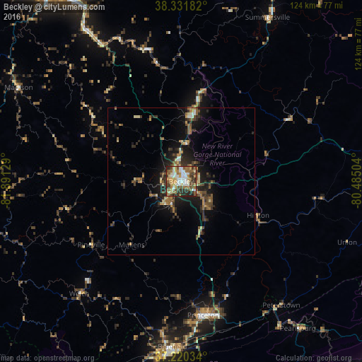
Analysis of Beckley night lights 2016
Square area 10x10 km:
 14.46%
90-99
13.1%80-89
12.07%70-79
6.29%60-69
12.93%50-59
10.03%40-49
12.59%30-39
8.5%20-29
9.86%10-19
0.17%0-9
0%Square area 50x50 km:
0.68%90-99
0.87%80-89
1.18%70-79
1.02%60-69
1.27%50-59
1.82%40-49
1.64%30-39
1.75%20-29
3.09%10-19
6.33%0-9
80.35%Clear (daylight) street map image can be seen on geolist.org.
Map coordinates:
38° 19' 54.6" North, 81° 53' 28.6" West
37° 46' 41.4" North, 81° 11' 17.4" West
37° 13' 13.2" North, 80° 29' 6.1" West
Some cities around Beckley sort by population:
• Charleston
74.5 km =46.3 mi,  328°
328°
• South Charleston
79.4 km =49.3 mi, 325°
• Saint Albans
88.2 km =54.8 mi,  319°
319°
• Bluefield
56.6 km =35.2 mi,  183°
183°
• Oak Hill
21.9 km =13.6 mi,  9°
9°
• Dunbar
80.7 km =50.1 mi, 323°
• Princeton
46.4 km =28.8 mi,  170°
170°
• Bluefield
58.9 km =36.6 mi,  187°
187°
4798308 (p: 17,056)
Sources (retrieved 2019-11-25):
» Earth at Night: Flat Maps 2012, 2016