Charleston night lights from space
Night Light of Charleston (West Virginia) from space (United States) Src. Average luminocity for 10x10km area is 70.415% and for 50x50km: 16.7397%.
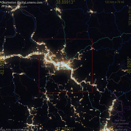
Analysis of Charleston night lights 2016
Square area 10x10 km:
 16.5%
16.5%90-99
16.84%80-89
8.84%70-79
7.99%60-69
9.18%50-59
18.03%40-49
11.73%30-39
3.74%20-29
7.14%10-19
0%0-9
0%Square area 50x50 km:
1.99%90-99
2.27%80-89
1.4%70-79
1.74%60-69
2.28%50-59
3.48%40-49
2.98%30-39
3.6%20-29
5.98%10-19
10.22%0-9
64.07%Clear (daylight) street map image can be seen on geolist.org.
Map coordinates:
38° 53' 56.9" North, 82° 20' 8.7" West
38° 20' 59.4" North, 81° 37' 57.4" West
37° 47' 46.7" North, 80° 55' 46.2" West
Some cities around Charleston sort by population:
• Teays Valley
28.2 km =17.5 mi,  293°
293°
• South Charleston
6.2 km =3.9 mi, 289°
• Saint Albans
18.2 km =11.3 mi,  282°
282°
• Cross Lanes
15.9 km =9.9 mi,  299°
299°
• Oak Hill
59.6 km =37 mi,  134°
134°
• Dunbar
9.2 km =5.7 mi, 277°
• Nitro
19.8 km =12.3 mi, 291°
• Hurricane
35 km =21.7 mi, 285°
4801859 (p: 49,736)
Sources (retrieved 2019-11-25):
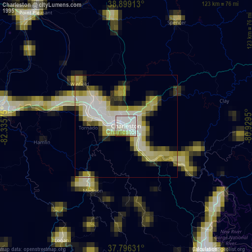
» NASA, Earths city lights 1995
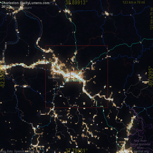
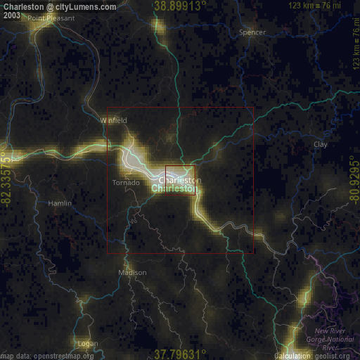
» NASA city lights 2003
» Earth at Night: Flat Maps 2012, 2016