Saint Albans night lights from space
Night Light of Saint Albans (West Virginia) from space (United States) Src. Average luminocity for 10x10km area is 52.5051% and for 50x50km: 16.4505%.
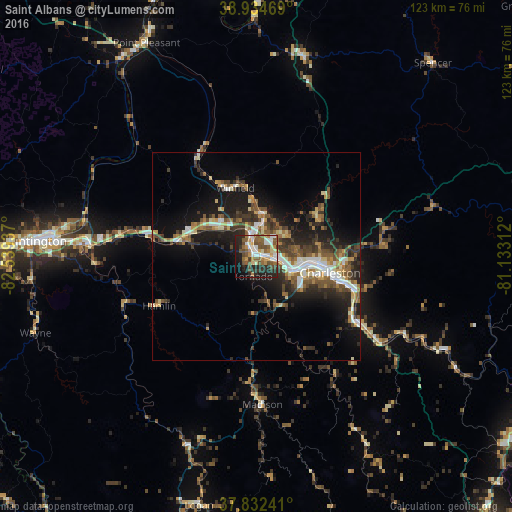
Analysis of Saint Albans night lights 2016
Square area 10x10 km:
 9.35%
9.35%90-99
10.37%80-89
3.74%70-79
7.31%60-69
7.31%50-59
13.95%40-49
9.69%30-39
4.76%20-29
18.54%10-19
10.71%0-9
4.25%Square area 50x50 km:
2.11%90-99
2.49%80-89
1.52%70-79
1.74%60-69
2.21%50-59
3.28%40-49
2.71%30-39
3.02%20-29
5.62%10-19
10.87%0-9
64.41%Clear (daylight) street map image can be seen on geolist.org.
Map coordinates:
38° 56' 4.9" North, 82° 32' 21.7" West
38° 23' 8.3" North, 81° 50' 10.5" West
37° 49' 56.7" North, 81° 7' 59.2" West
Some cities around Saint Albans sort by population:
• Charleston
18.2 km =11.3 mi,  102°
102°
• Teays Valley
10.8 km =6.7 mi,  311°
311°
• South Charleston
12.1 km =7.5 mi, 99°
• Cross Lanes
5.5 km =3.4 mi,  45°
45°
• Dunbar
9.1 km =5.7 mi,  107°
107°
• Nitro
3.3 km =2.1 mi,  348°
348°
• Pea Ridge
42.3 km =26.3 mi,  274°
274°
• Hurricane
16.9 km =10.5 mi,  288°
288°
4820938 (p: 11,044)
Sources (retrieved 2019-11-25):
» Earth at Night: Flat Maps 2012, 2016